Paved UNESCO
Upper Azat valleyMonastery
Upper Azat valley — Dragon-slayers, chained titans and ancient stones
from$1,364per person, based on 5 guests
A journey along the great myths of the Caucasus — from the sun temple and cliff monastery at Garni and Geghard, past the abandoned fortress ruin of Smbataberd to the stone rows of Karahunj, up to the ancient petroglyphs of Ughtasar, down into the cave town of Khndzoresk and to the cliff monastery of Tatev with a bathe at the Devil’s Bridge. By campfire and in guesthouses, our guides tell the legends of Vahagn, Hayk and Ara.
Six days, five nights, and the difficulty rating of 3 out of 5 describes the average rather than the week. Four of the six days run entirely on a firm surface — trunk road, mountain road, made-up approach. Two carry that figure on their own: on day two a gravel and dirt track that climbs onto a ridge in Vayots Dzor, on day four a highland track that rises to 3,300 metres in Syunik. Judge the route by the number on the fact card and you will underrate those two days and overrate the other four.
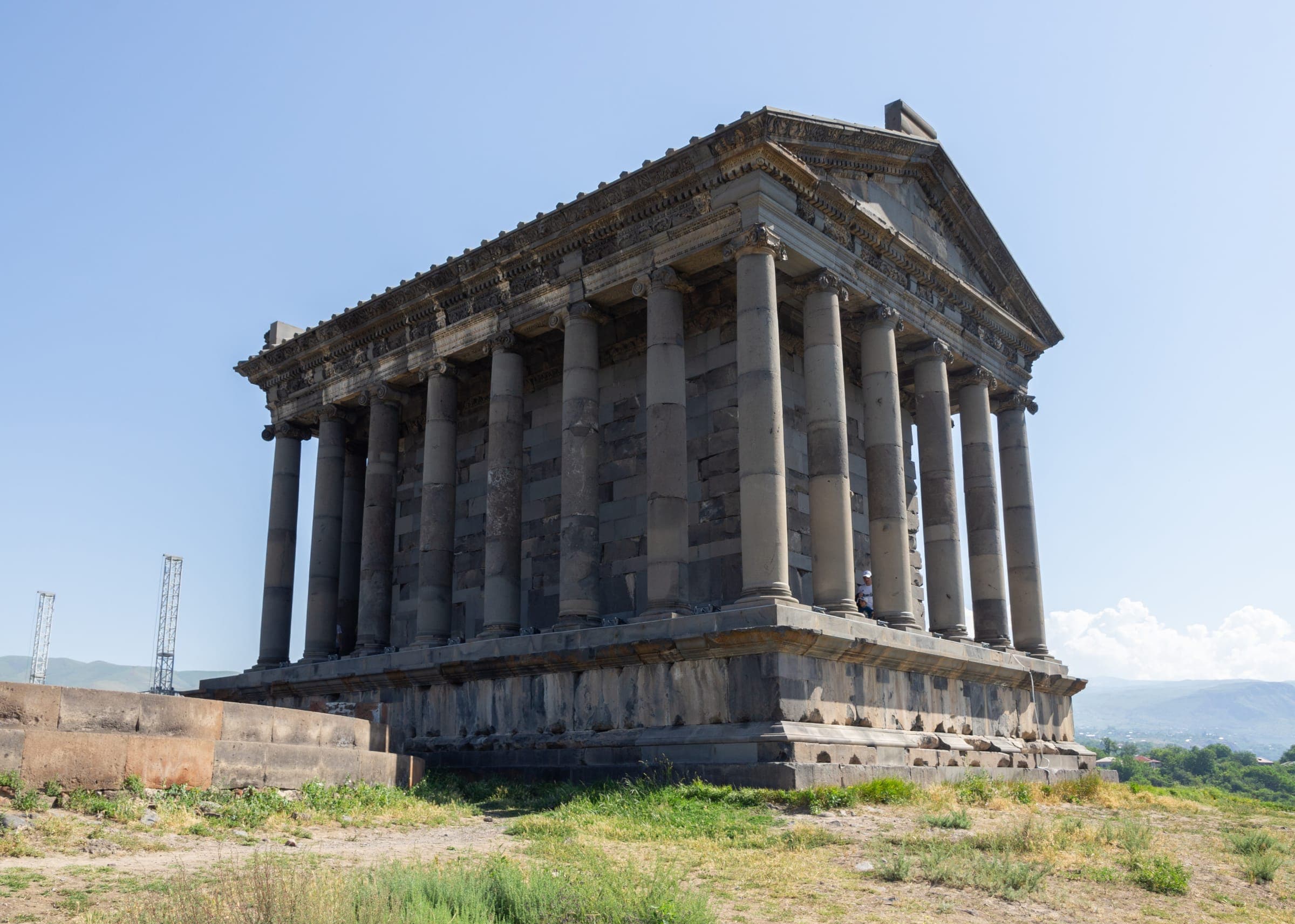
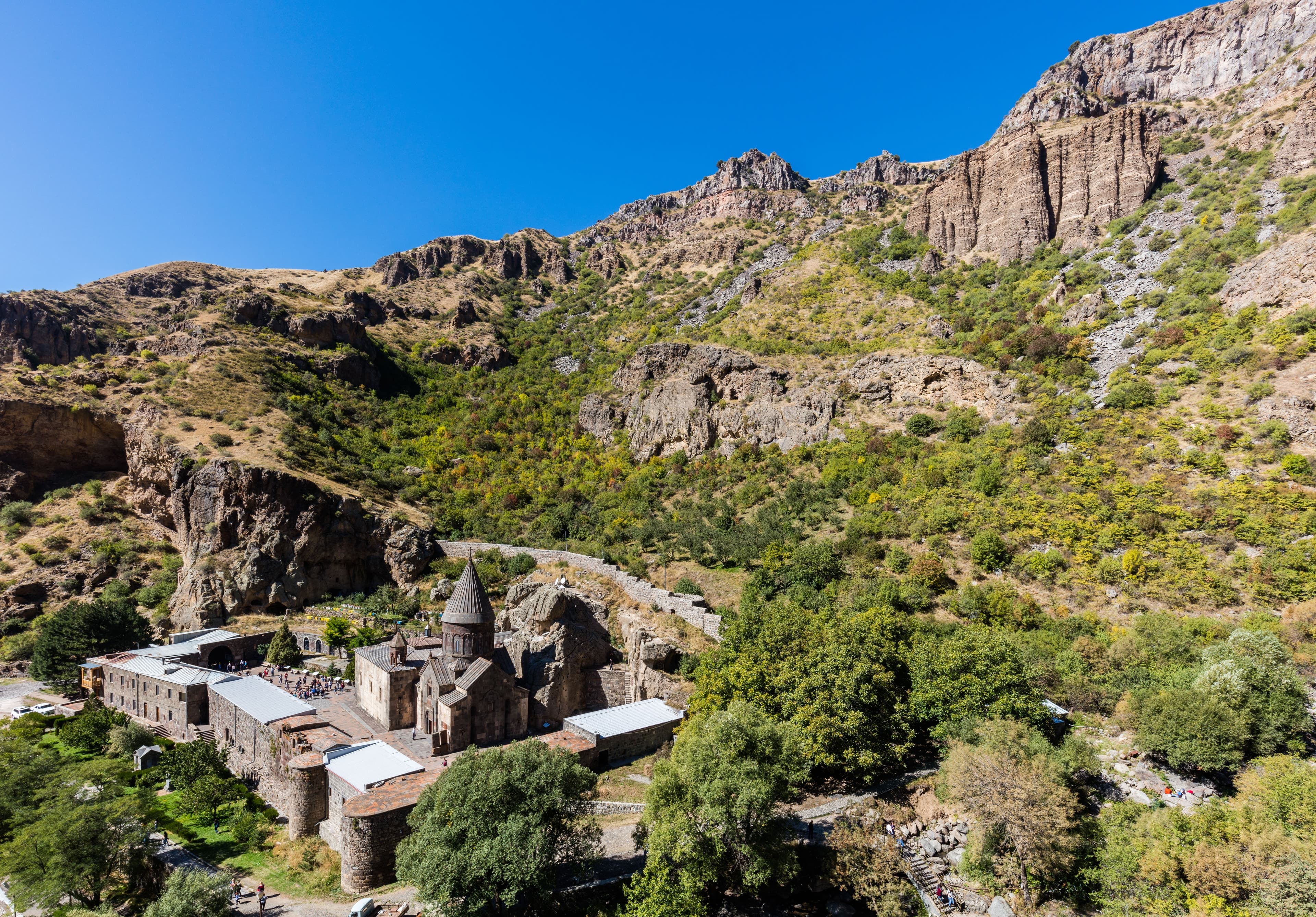
The opening stays within reach of Yerevan, some 990 metres up. Twenty-eight kilometres east, sealed the whole way, and you park on the rock terrace above the Azat gorge, where Garni Temple & Fortress sit at about 1,400 metres. Ten kilometres further the road works up the valley, narrows, and at the end the gorge closes into a bowl of vertical basalt: that is where Geghard Monastery stands at roughly 1,800 metres. Off-road factor 1 at both places, parking right by the entrance; the effort only starts where you continue on foot. Come evening you are back in Yerevan.
Day two is where the terrain begins. The M2 runs 123 kilometres south-east to Yeghegnadzor at 1,194 metres, then the road turns off into the Yeghegis valley, a shade under fourteen kilometres to Artabuynk. Out of the village a gravel-and-dirt track works its way up onto the ridge, steep and full of bends: firm gravel in places, loose scree in others, deeply scoured ruts once it has been wet. Low range and ground clearance are not a reserve here but a condition; off-road factor 4 of 5. On top, at around 2,000 metres, Smbataberd Fortress sits on a spur of the Vardenis range, guarded by sheer drops on three sides. The last stretch into the walls goes along the crest on foot.
Day three is a transfer: eighty-six kilometres of M2 up onto the volcanic tableland, with the crest at 2,344 metres on the provincial line — sealed, steep, and not dependably open under heavy snowfall. Sisian, 217 kilometres out from Yerevan, lies at 1,600 metres; four kilometres of made-up road lead out to the pierced blocks of Zorats Karer at 1,770 metres. Day four then belongs to the track: seventeen kilometres from the village of Ishkhanasar, some 1,400 metres of climb in one go into the caldera that holds the Ughtasar Petroglyphs at 3,300 metres. The window for it is tighter than the season: the approach is clear between mid-July and the end of August, and after that only with luck. Book in June or October and that day gets a different off-road stage around Sisian — what lies up there is decided by the snow.
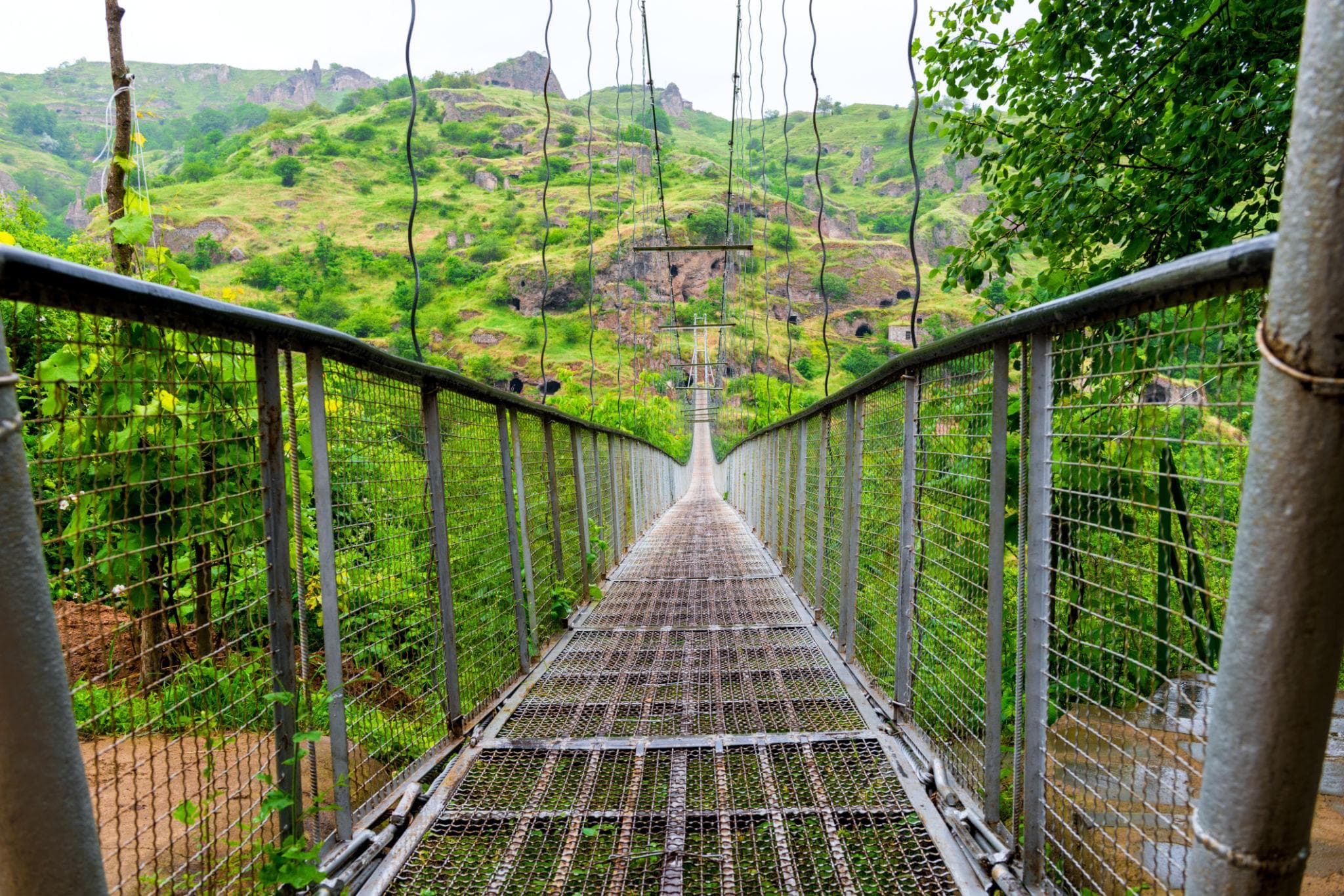
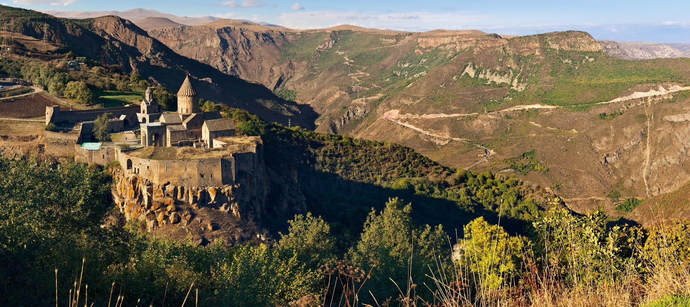
Day five is the full one: 139 kilometres, all of it firm, and three quite different roads all the same. Thirty-eight down to Goris at roughly 1,385 metres, fifteen out to the lip of the tuff canyon above Old Khndzoresk, 1,580 metres up — that is where driving stops, and stairs and suspension bridge are a job for your legs. Then the mountain road towards Tatev Monastery, also at 1,580 metres; the gorge itself is crossed by the cableway out of Halidzor over 5.7 kilometres, and the ticket is among the listed services. Last the road falls in hairpins to 1,020 metres and Satani Kamurj, where the spring water leaves the rock at around 25 degrees. Day six is 254 kilometres of road back. The roof over your head depends on the comfort class and not on the place: in Expedition a guesthouse, in Signature a hotel with a spa, in Frontier the wild camp. The vehicles travel in convoy, eight guests at most; on days two and four the lead guide runs in front if you are driving yourself.
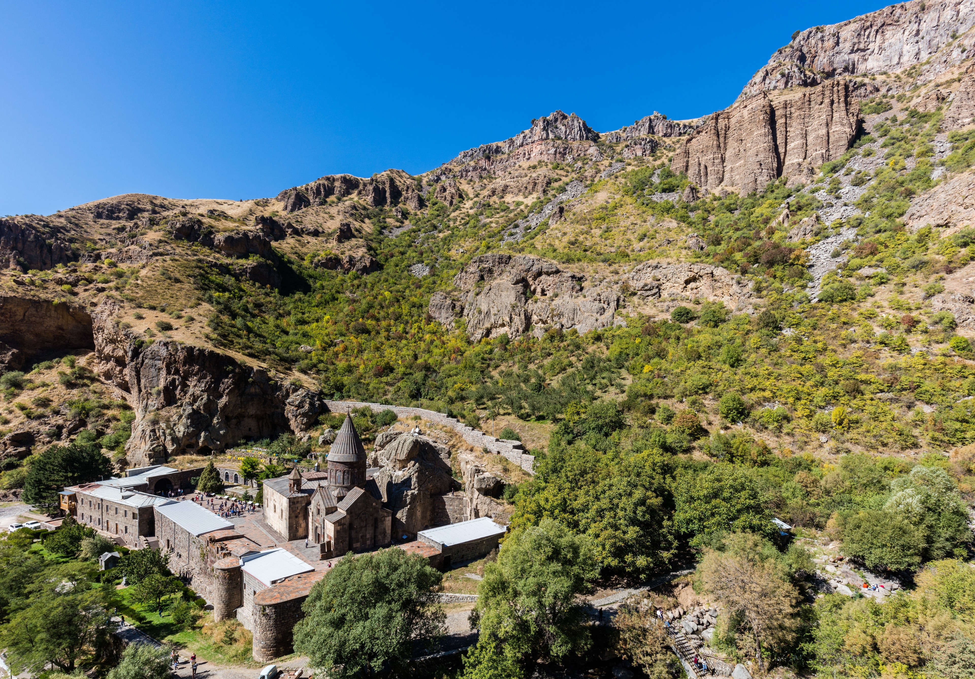
The pagan temple of Garni, poised high above its gorge, and the rock-hewn monastery of Geghard, a UNESCO World Heritage Site — the opening chapter of a journey through the highland’s oldest legends.
Seventy-seven kilometres, a good hour and a half at the wheel, not a metre of it unmade. Twenty-eight run east to the terrace above the Azat gorge, ten more up the valley into the basalt bowl at 1,800 metres. Both car parks sit at the entrance; the effort only starts on the steps beyond them. The shortest driving day of the week — time for tyre pressure, load and seating position before tomorrow’s first track.
77 km · Driving time 1 h 45 · Elevation 990 → 990 m · highest point 1,800 m · tarmac 100 %
We drive to Yeghegnadzor and climb to the lonely fortress ruin of Smbataberd on its ridge — tradition holds it never fell in open battle, but to betrayal.
A good three hours of actual driving, and the last section decides the day. Up to Yeghegnadzor at 1,194 metres the M2 asks nothing of you; after that comes the Yeghegis valley and, beyond Artabuynk, the track: steep, winding, firm gravel alternating with loose scree, deep ruts after rain. Engage low range, adjust tyre pressure, keep your distance. At the top, around 2,000 metres and sheer drops on three sides.
Driving time 3 h 15 · Elevation 990 → 1,194 m
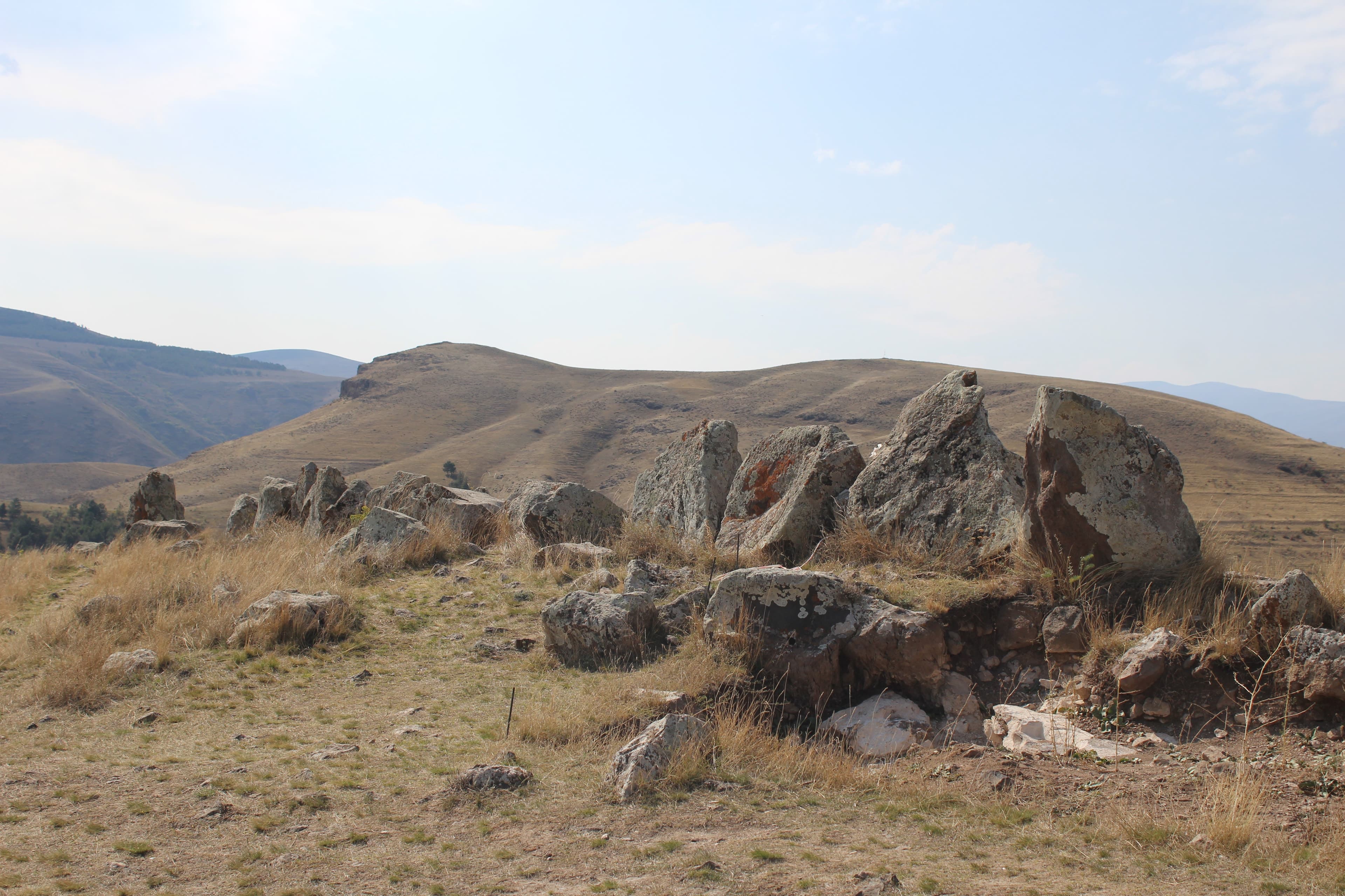
Via Sisian to the pierced stone rows of Zorats Karer, the “Armenian Stonehenge”, said to have charted the night sky for thousands of years.
Two hours, eighty-six kilometres of trunk road and a crest at 2,344 metres on the boundary between the two provinces — sealed, steep, and not dependably open under heavy snowfall even outside winter. After that the road drops to Sisian at 1,600 metres. Four kilometres of made-up approach lead out onto the plateau to the pierced blocks at 1,770 metres; the wind blows there, August included. A short day, deliberately so.
95 km · Driving time 2 h · Elevation 1,194 → 1,600 m · highest point 2,344 m · tarmac 100 %
An off-road climb to 3,300 metres and the petroglyphs of Ughtasar: ibex, hunters and celestial symbols, pecked into the rock by shepherds millennia ago.
The same line out and back, four hours of actual driving all told. Beyond Ishkhanasar the vehicle leaves the surface and takes on seventeen kilometres of highland track with roughly 1,400 metres of climb: scree that slips away as you pull off, rock steps at walking pace, fords whose level rises as the day goes on. At the top the bowl and its mountain lake lie at 3,300 metres — the highest point of the week and the only one above 3,000. A second night in Sisian.
Driving time 4 h · Elevation 1,600 → 1,600 m · highest point 3,300 m
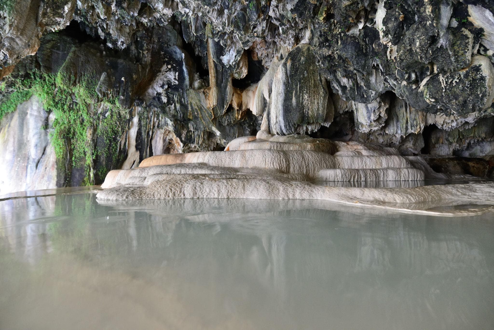
The cave town of Khndzoresk and its swaying suspension bridge, then the “Wings of Tatev” cableway to the cliff-top monastery — named, legend says, for the builder who begged God for wings — before a closing bathe in the warm pools of Satani Kamurj.
Three and a half hours, 139 kilometres, and three different roads all the same. First thirty-eight down to Goris, then fifteen out to the rim above the tuff canyon at 1,580 metres, where driving stops. After that the mountain road west; the gorge itself is taken by the cableway out of Halidzor, 5.7 kilometres across. Last the hairpins that drop to 1,020 metres: narrow, steep, engine braking rather than the pedal, and coaches round the bend. Swim kit pays off.
139 km · Driving time 3 h 30 · Elevation 1,600 → 1,385 m · tarmac 100 %
A long drive back via Sisian and Yeghegnadzor to Yerevan, departure.
The way back retraces the outward road, only in reverse and without a turn-off. Out of the valley of Goris it climbs to the tableland again, takes the 2,344 metres beyond Sisian and runs on north-west past Yeghegnadzor. Under cloud that crest is simply a place to ease off, nothing more. 254 kilometres, a good four hours, and in the afternoon the vehicle goes back at 990 metres in Yerevan.
254 km · Driving time 4 h 15 · Elevation 1,385 → 990 m · highest point 2,344 m · tarmac 100 %
Upper Azat valleyMonastery
KotaykFortress
near Sisian, SyunikArchaeology
near Goris, SyunikCave town
Syunik, Southern ArmeniaMonastery
Vorotan gorge, SyunikNature
Packing list
Questions about this tour
Two things make it what it is: the gradient and the shifting surface — together they come to off-road factor 4 of 5. Out of Artabuynk a gravel and dirt track winds up in bends; firm gravel gives way to loose scree, and after rain deeply scoured ruts are left behind. Four-wheel drive with low range is a condition, and so is decent ground clearance. At the top the vehicle takes you onto the ridge; into the walls of Smbataberd Fortress the last stretch runs along the crest on foot. What the vehicles carry for all this is set out on the page about the safety standards.
It does not fall away, it changes its destination. At 3,300 metres, in a bowl the snow holds for the greater part of the year, sit the Ughtasar Petroglyphs; the way up is clear between mid-July and the end of August, and with a little luck still in September. The programme itself sets off between June and October, so the two do not coincide. Book outside the tighter window and a different off-road stage around Sisian is settled for that day — rather than an attempt that ends at a snowfield.
Deliberately so. Garni and Geghard both sit on asphalt and only ten kilometres apart, and the week opens without terrain on purpose: 77 kilometres, a good hour and a half of driving, Yerevan again by evening. The day belongs to the handover and to settling in — seat, mirrors, load, tyre pressure — so that on the second morning nobody is hunting for low range for the first time. Then there is the altitude: Yerevan sits at 990 metres, the bowl around Geghard Monastery at 1,800, and three days later it is 3,300. A quiet opening is not wasted time against that.
They belong to their places, and there they are set out at more length than a route description can manage. Every station on the route carries a section on tradition and myth on its own page — at Garni Temple & Fortress as much as at the stone rows of Zorats Karer or at Tatev Monastery. On the road that job falls to the person accompanying you; in the listed services they appear as guide and storyteller. This text sticks to what happens between the places: surface, altitude, gradient and the question of how long the day at the wheel becomes.
Two ascents: the ridge above Artabuynk and the caldera
Of six days, two ask for your full attention, and they ask for it on different grounds. On the ridge above Artabuynk it is the gradient together with the surface: what is firm gravel in dry weather turns into a rut after a thunderstorm, and a rut is not taken with momentum but after somebody has got out and looked at it. In the caldera it is the altitude. At 3,300 metres every task takes longer, and a clear morning can turn to sleet by midday; that is why the start is early and the decisions are early too. On both stages the vehicles move in turn: one goes, the next waits until the spot is free. Turning back is no defeat in that scheme but one of the options open from the outset. Anyone who feels a headache or nausea up there says so before it gets worse — the answer then is downhill.
Satellite communication on every route
Every group carries satellite messaging and tracking. Where the mobile network ends, the connection stays up, and help can be called from any point on the route.
Recovery gear and reserves on board
Winch, recovery straps, tools, spare fuel and spare water travel in every vehicle. In the convoy a second vehicle is always within reach, and the margin is planned before it is needed.
First aid and pre-planned routes to help
Comprehensive first-aid kits, guides trained in wilderness first aid, and routes to the nearest medical facility planned in advance for every stage.
Fixed dates or your own timing — guided or self-driven. We reply personally.