Explorer
Volcanoes & Geysers
5 days
3,300 m
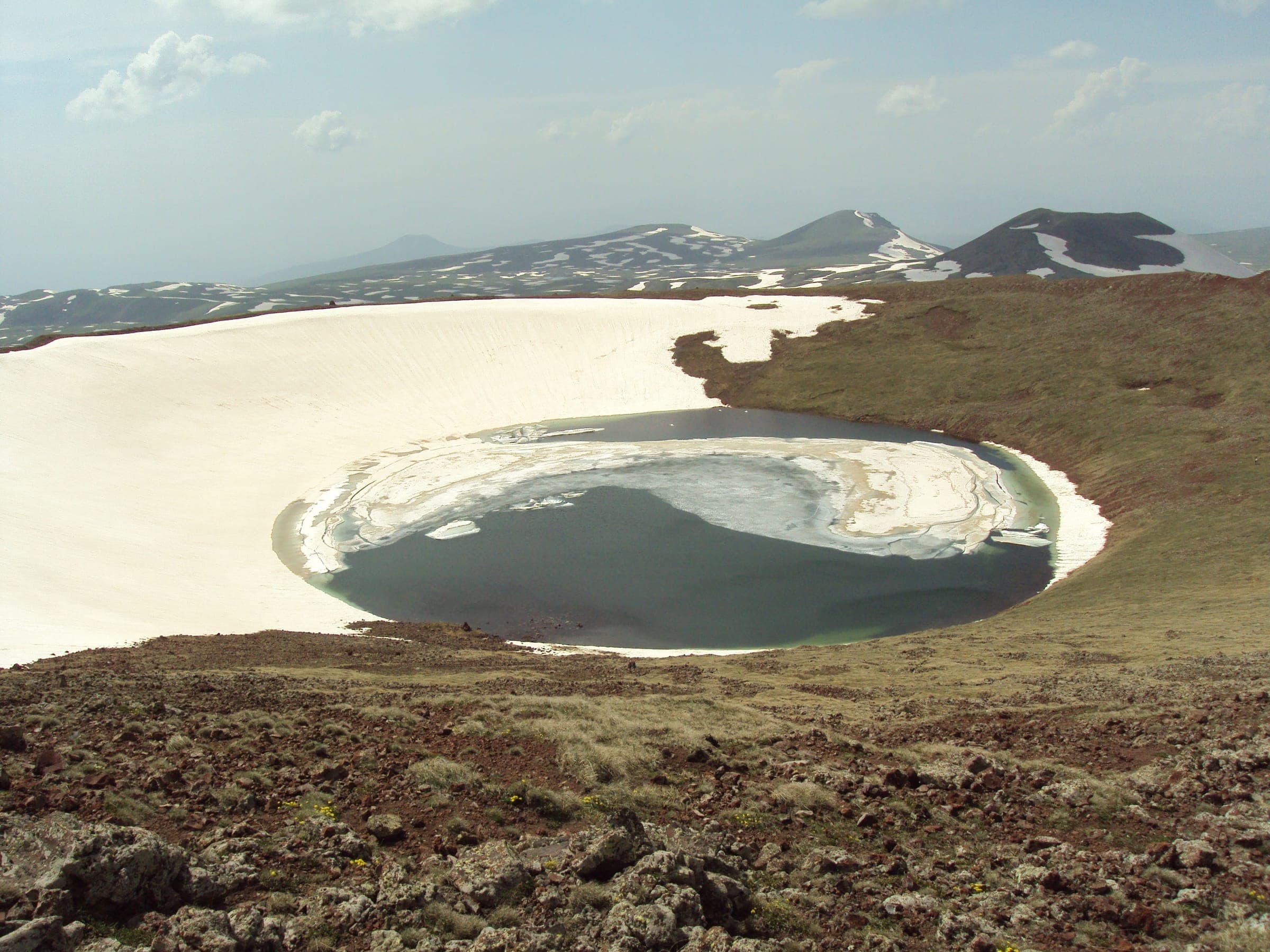
Syunik — In the crater basin of the extinct Ughtasar volcano, thousands of carved basalt blocks ring a glacial mountain lake - reachable only for a few summer weeks and only by 4x4.
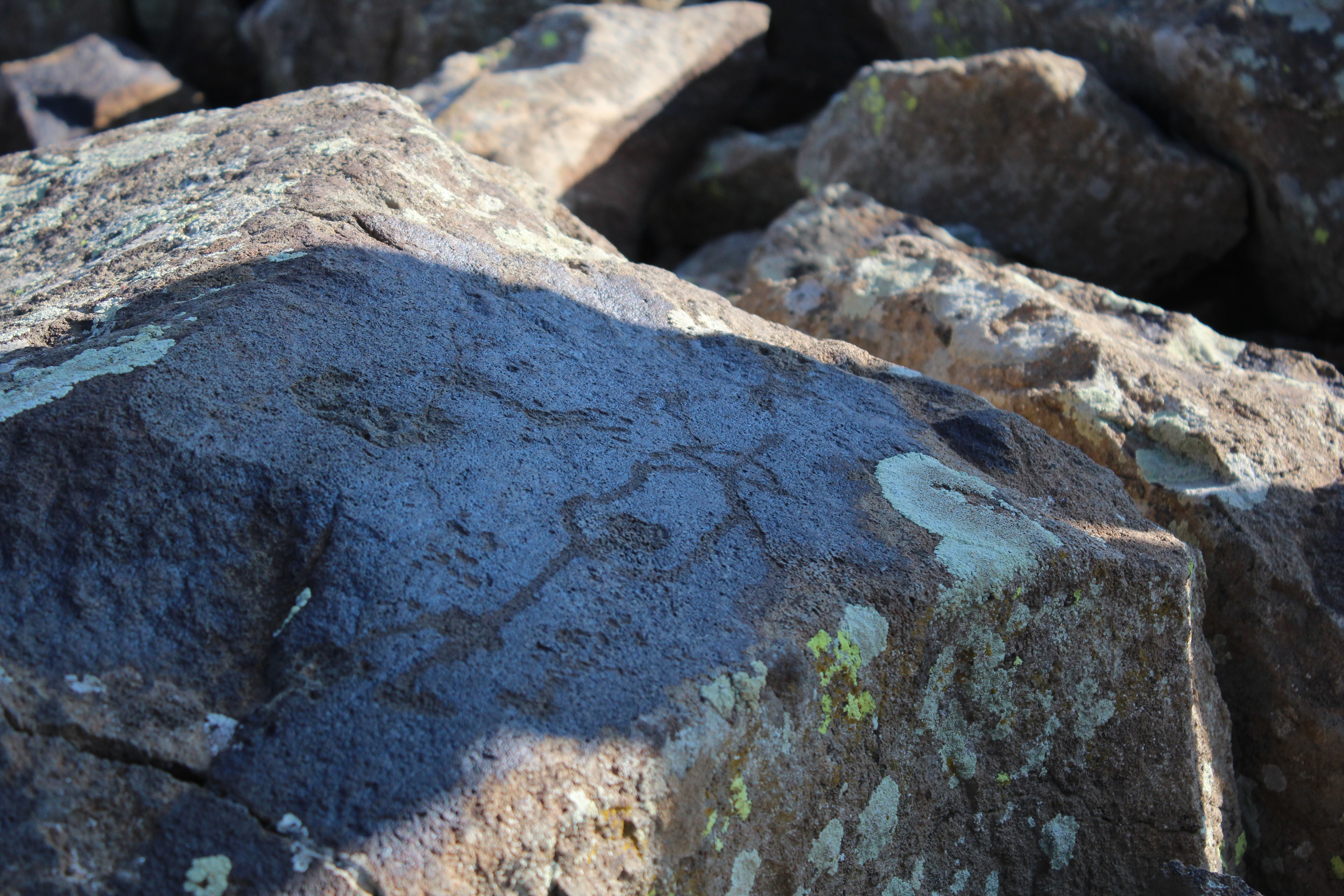
Two out of three figurative motifs show ibex with oversized horns – read as hunting luck or protective magic, never conclusively deciphered. The name wavers between Camel Mountain and Pilgrim Mountain, and in the thin air at 3,300 metres you feel for yourself why every step around the lake costs effort. Some signs are even said to speak of the Vishap, the water spirits of the region.
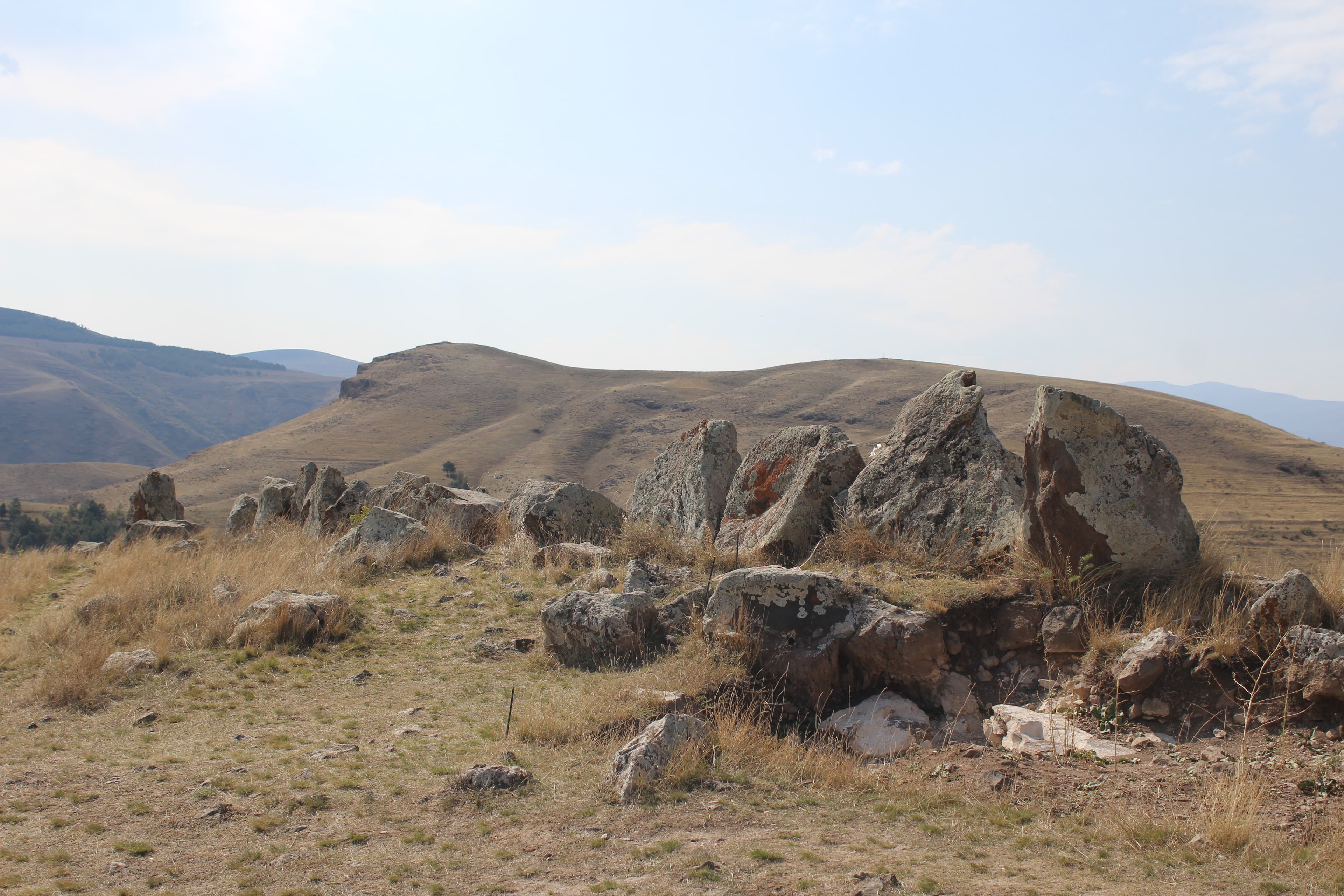
Ughtasar sits in the Tsghuk massif in the Syunik region, about 17 km from the village of Ishkhanasar. At roughly 3,300 m, the crater basin (caldera) of the extinct volcano opens up, about 1.5 x 1 km in size. A glacial mountain lake fills the hollow, dammed at its southern edge by a natural wall of rock blocks. Hundreds to thousands of basalt blocks are scattered around the hollow - once thrown out as lava, later worked by hand.
Offroad & access
From Ishkhanasar, about 17 km of highland track to the caldera; roughly 1,400 m of ascent up to around 3,300 m. Surface: loose scree, rock steps, meltwater fords; higher sections often hold patches of snow into the summer. Required: a capable 4x4 with all-wheel drive and low range. Several hours of driving. The altitude is noticeable - move calmly, the air is thinner.
Region: Syunik. Nearest town: Sisian. Nearest village: Ishkhanasar. Location: caldera of the Ughtasar volcano (Tsghuk massif), glacial mountain lake. Elevation: approx. 3,300 m. Coordinates: 39.684 N / 46.05 E. Type: petroglyphs. Scope: depending on the count, just under a thousand to more than 2,000 carved basalt blocks. Dating: mainly Chalcolithic (4th millennium BCE), Bronze Age (3rd-2nd millennium BCE), early Iron Age; dated via motifs and surface finds (obsidian, ceramics). Motifs: ibex/mouflon (about two-thirds of the figurative depictions), deer, predators, hunting and dancing scenes, wagons, spirals, concentric circles, sun symbols. Best season: mid-July to mid/late September, mainly July and August. Off-road factor: 5 out of 5.
One of Armenia's more significant rock art ensembles. The basalt blocks were thrown out as lava during Tsghuk's eruptions, their surfaces later worked by pecking (chipping out individual points). The images cannot be dated directly — no reliable scientific method for dating petroglyphs directly exists yet — so they are placed in time via motif chronology and surface finds. In 1970, Karakhanian and Safian proposed a range of the 5th to 2nd millennium BCE for the region's rock art; findings from the ongoing project largely agree with this. Wagon motifs date no earlier than the arrival of the wheeled vehicle (early 3rd millennium BCE); yoked cattle and plough may be older (4th-3rd millennium). The main phase is Chalcolithic and Bronze Age, extending into the early Iron Age; the site was presumably used by herding groups during the mountain summer. Broader research began in the early 20th century and intensified from the 1960s. The Ughtasar Rock Art Project has systematically documented the petroglyphs in their landscape context since 2009, with specialists from Armenia, the UK, Japan and the USA. Not fully deciphered.
The name has two readings (according to tradition): 'ught' = camel -> 'Camel Mountain'; 'ukht' = pilgrimage -> 'Pilgrim Mountain'. According to legend, the carvings are interpreted, not read. The ibex (about two-thirds of the figurative motifs) is associated with hunting, fertility or protection. Spirals and circles are interpreted as sun or sky signs, with occasional hints of calendars or constellations. Tradition links the site to the Vishap (water and spring spirits, 'dragon stones'/vishapakar). No interpretation is proven; it remains interpretation.
Thousands of Chalcolithic and Bronze Age carvings at 3,300 m, in a caldera about 1.5 x 1 km. The season window is only a few weeks (snow for most of the year); access is only via a demanding highland track (about 1,400 m of ascent). Basalt blocks beside a still glacial lake, with no infrastructure.
Realistically passable from mid-July to mid/late September, reliably in July and August; otherwise snow. From Ishkhanasar, about 17 km of highland track, around 1,400 m of ascent. A capable 4x4 with all-wheel drive and low range is needed; do not drive alone without a second vehicle. Plan for acclimatization and move calmly at altitude. Weather at 3,300 m turns quickly: bring warm, wind- and waterproof clothing, sturdy footwear, UV protection, water and food. Go only with experienced guidance; check access and safety in advance. Do not touch or trace the carvings.
near Sisian, SyunikArchaeology
SyunikLake
near Sisian, SyunikNature
Want to visit the Ughtasar petroglyphs? Armenia Expeditions arranges the approach along the highland track with a suitable 4x4 and a local guide, timed to the short season window in July and August. One message — we’ll plan the rest.