Paved
Ararat plainMonastery
Ararat plain — The oldest churches on earth, gently explored
from$1,266per person, based on 5 guests
The most comfortable of our journeys: gentle stages to the holiest places of the first Christian nation — Etchmiadzin and Zvartnots, the rock monastery of Geghard, the temple of Garni and the basalt organ pipes of the Symphony of Stones, Khor Virap against the backdrop of Mount Ararat and the quiet sand dunes of Goravan, finally Noravank and a wine tasting in the ancient Areni-1 cave. Rich in culture, barely any off-road sections, excellent cuisine and top-class hotels. Ideal for a first visit to the Caucasus.
Five days, four nights, and difficulty 1 out of 5 — the lowest figure any route in this programme carries; the only other place it turns up is the one-day wine trip at Areni. That is a description rather than modesty. Whoever takes the wheel here spends three of the five days entirely on sealed surfaces, and the highest recorded point of the week, at 1,800 metres, sits below what other tours reach before lunch on their first day. The ten hours of actual driving are spread so evenly that no single day reaches three. If you want to know how a 4x4 behaves on Armenian trunk roads before the tracks begin, this is where to find out.
Two of the five days stay in the Ararat plain, the flattest ground Armenia has. Yerevan sits at around 990 metres; the M5 runs west from the city and gives up height slowly until, after a good twenty kilometres, Vagharshapat follows at 853 metres, where Etchmiadzin Cathedral stands. Day three goes the other way: the M2 south, a good forty kilometres to the hill that carries Khor Virap — 827 metres, and nothing on these five days sits lower. After that the route turns east, out beyond Vedi to the Goravan Sands State Reserve, where the only sand of the week lies at about 950 metres. Straight roads, irrigation ditches, lorries up from the south: what is asked for here is attention, not technique.
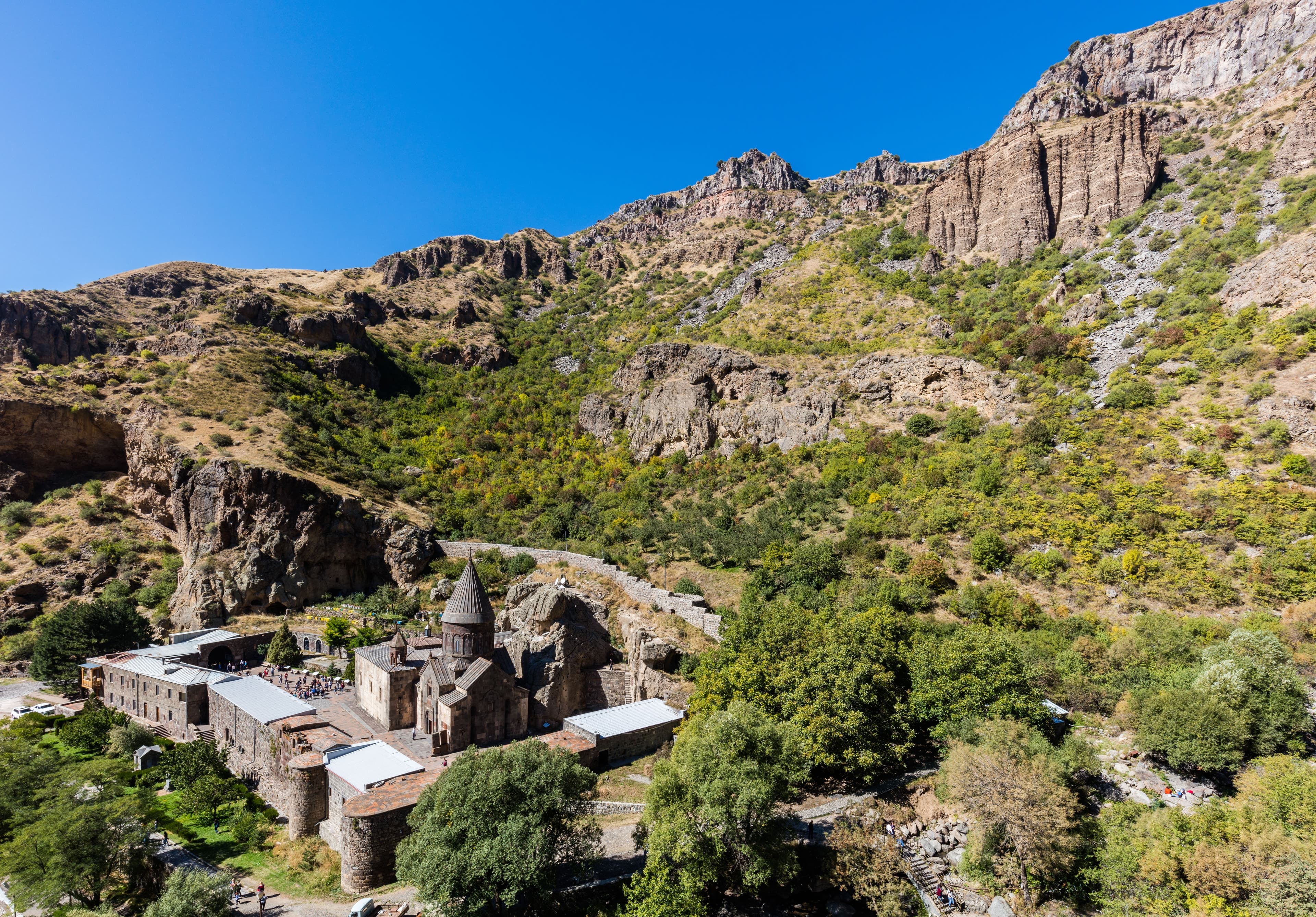
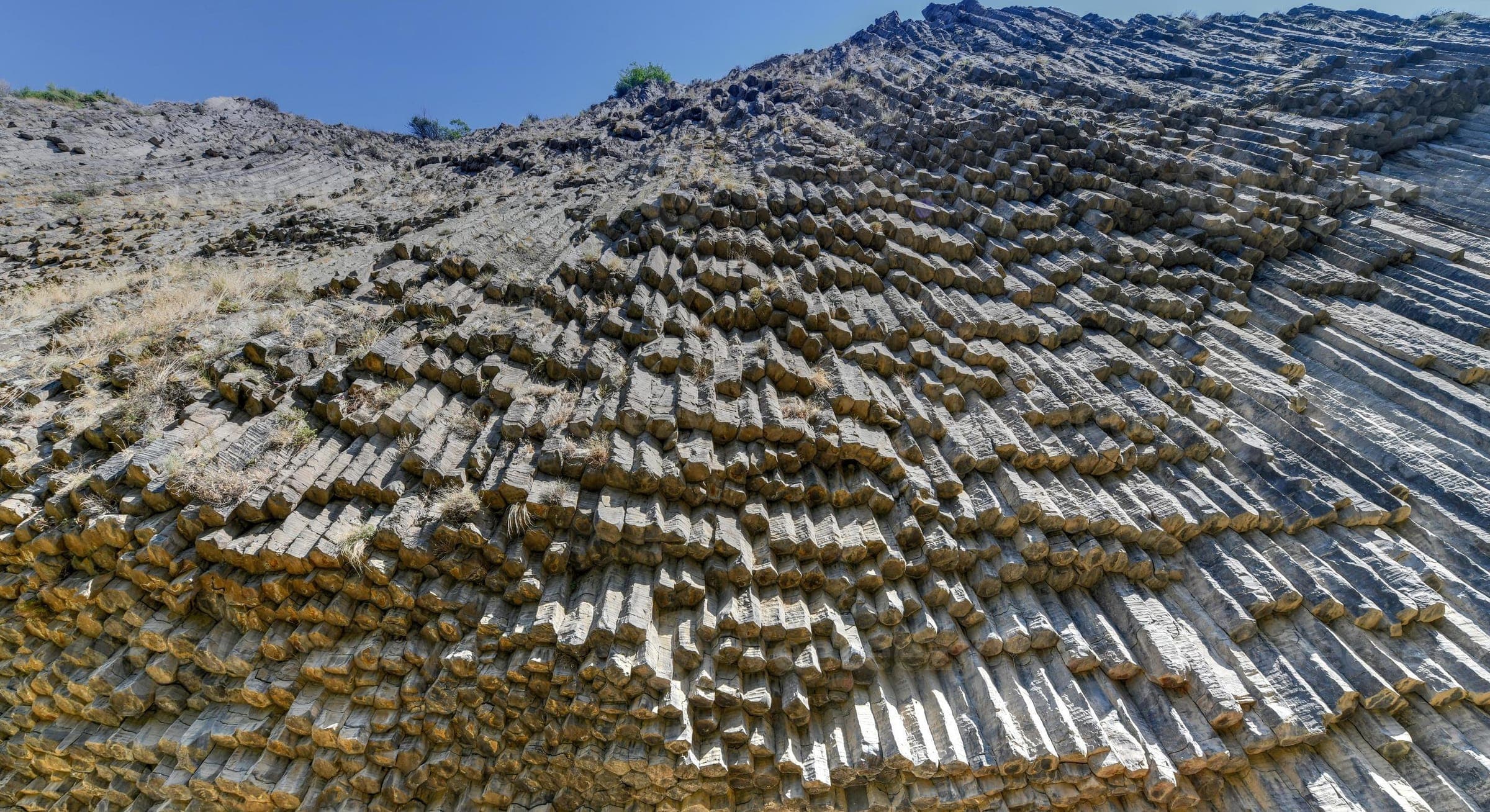
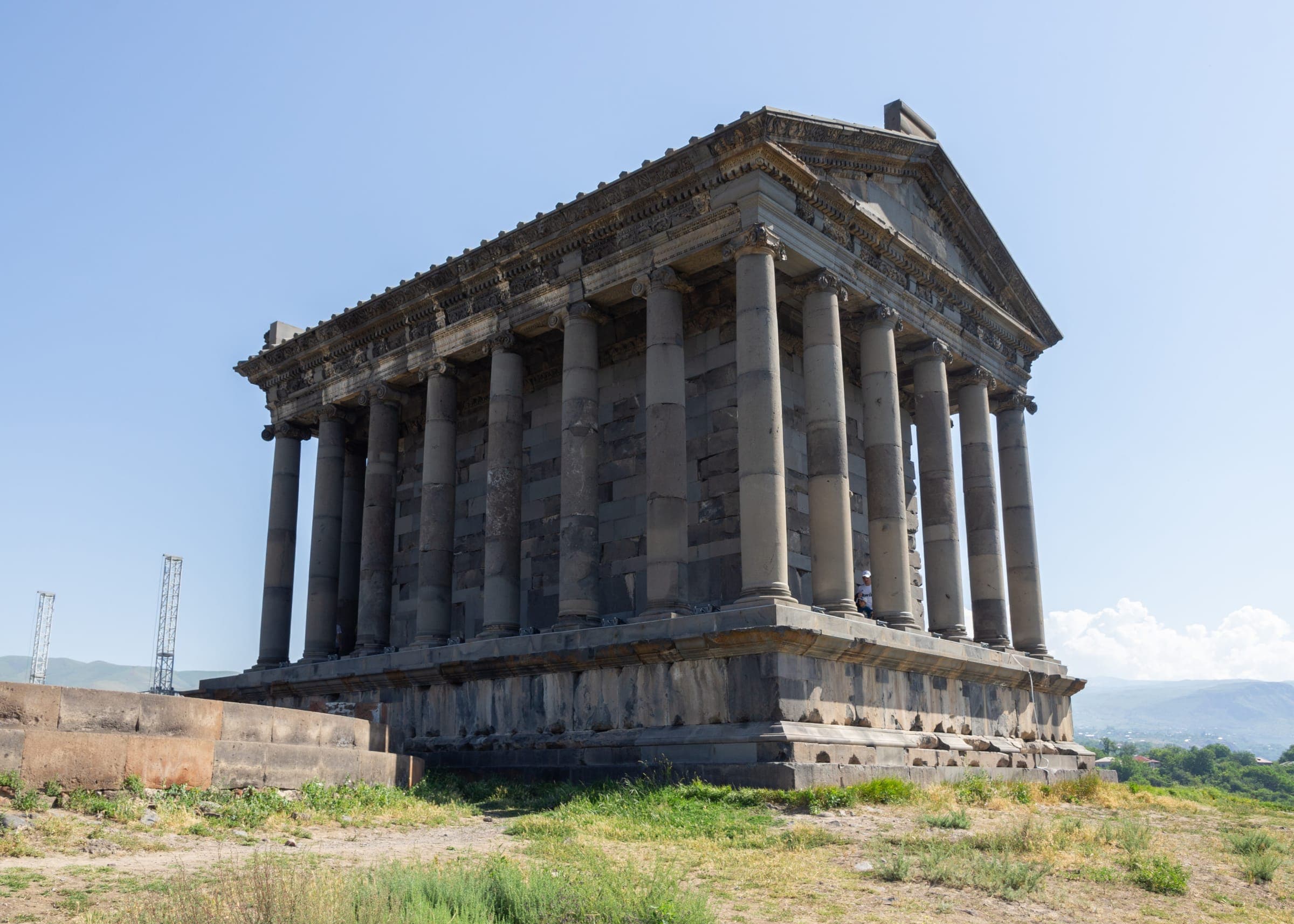
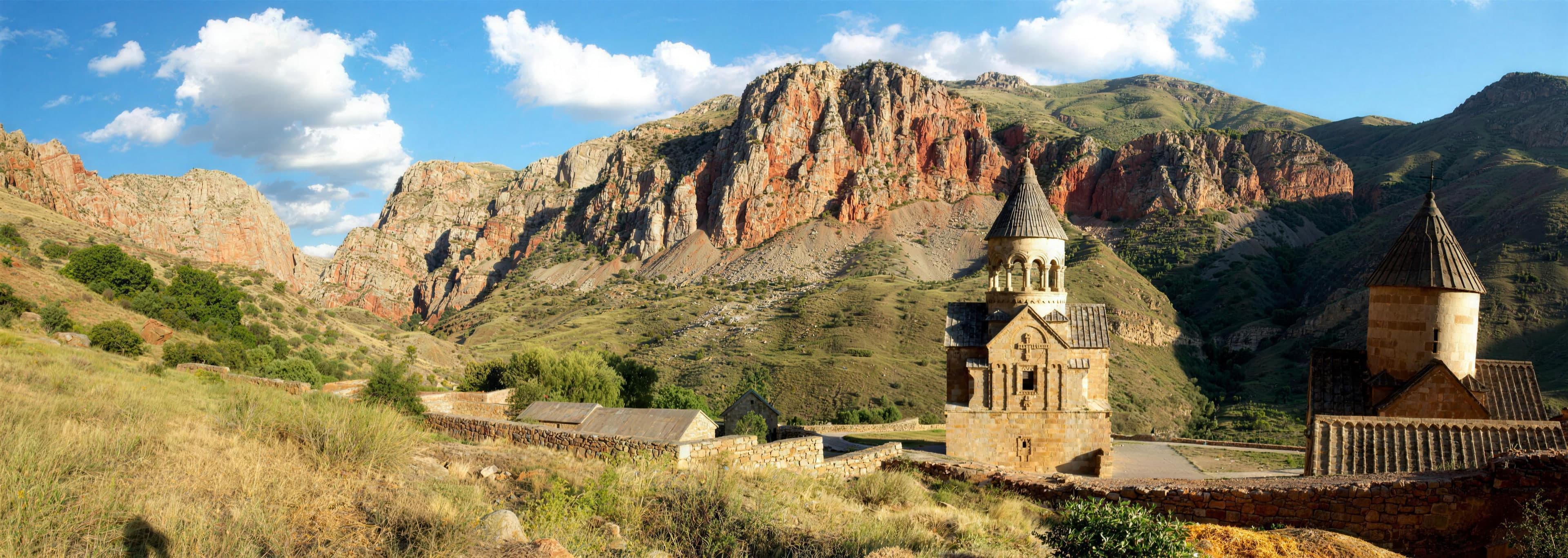
Day two turns east and upwards into the valley of the Azat. Twenty-eight kilometres on the H-3, and then the driving pauses on the rock spur occupied by Garni Temple & Fortress — about 1,400 metres up, with the Azat gorge directly below. From there a short spur drops into the gorge: asphalt gives way to gravel, and after rain water stands in the ruts. It ends at roughly 1,300 metres at the foot of the basalt wall of the Symphony of Stones. Together with the sand track at Goravan, that is every unsealed metre this route owns. Back on the main road the valley climbs another ten kilometres until the gorge closes into a bowl and Geghard Monastery appears at 1,800 metres — the highest recorded point of the five days, reached on a sealed surface throughout.
Only on day four does the route leave the orbit of the capital. The M2 runs a good 110 kilometres to the south-east until, at Areni and 990 metres, the Areni-1 Cave breaks out of the slope above the Arpa; then twelve sealed kilometres through the Amaghu gorge up to 1,591 metres, where Noravank Monastery stands at the head of the valley, and 1,194 metres in Yeghegnadzor by evening. Day five is the same road back. Three of the four nights therefore belong to a single room in Yerevan, with the luggage left where it is. Which room depends on the comfort class: in the Signature class it is a hotel with a spa. The group numbers eight guests at the most and stays together on the road; if you drive, you take every stage in one of the vehicles, from the first to the last. The season runs from April to October.
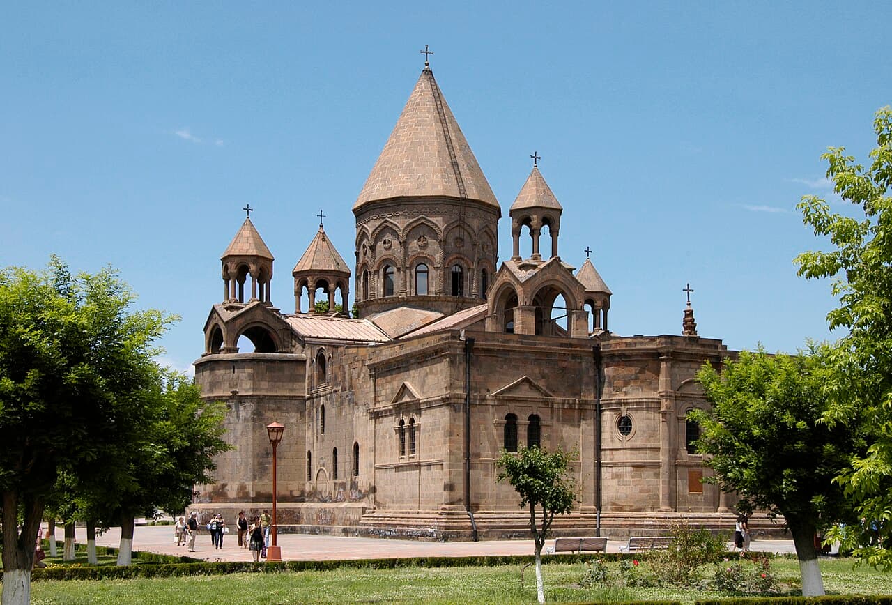
Arrival in Yerevan, a gentle start at the oldest cathedral in Christendom in Etchmiadzin and the ruins of Zvartnots.
Some forty kilometres out and back, about an hour at the wheel in total — the shortest driving day of the trip, and deliberately so on the day you arrive. The M5 leaves the city westwards and gives up a good 130 metres of height to Vagharshapat at 853 metres. Sealed all the way, parking outside the precinct, and the rest of the day belongs to your feet. The ruins of Zvartnots lie on the same road and cost no detour.
42 km · Driving time 1 h · Elevation 990 → 990 m
The rock-hewn monastery of Geghard, the pagan temple of Garni and the thundering basalt organ pipes of the Symphony of Stones — high above the gorge, the quiet monastery of Havuts Tar keeps watch, barely visible.
Three short legs, and just over two hours of driving all told: twenty-eight kilometres east on the H-3, the drop into the gorge and back up, then ten kilometres further up the valley. Between the plateau at around 1,400 metres and the rock bowl at 1,800 lie some four hundred metres of climb, and apart from the gravel track down to the river everything is sealed. Lowering tyre pressure pays only in the wet; ground clearance helps here every time.
Driving time 2 h 15 · Elevation 990 → 990 m · highest point 1,800 m
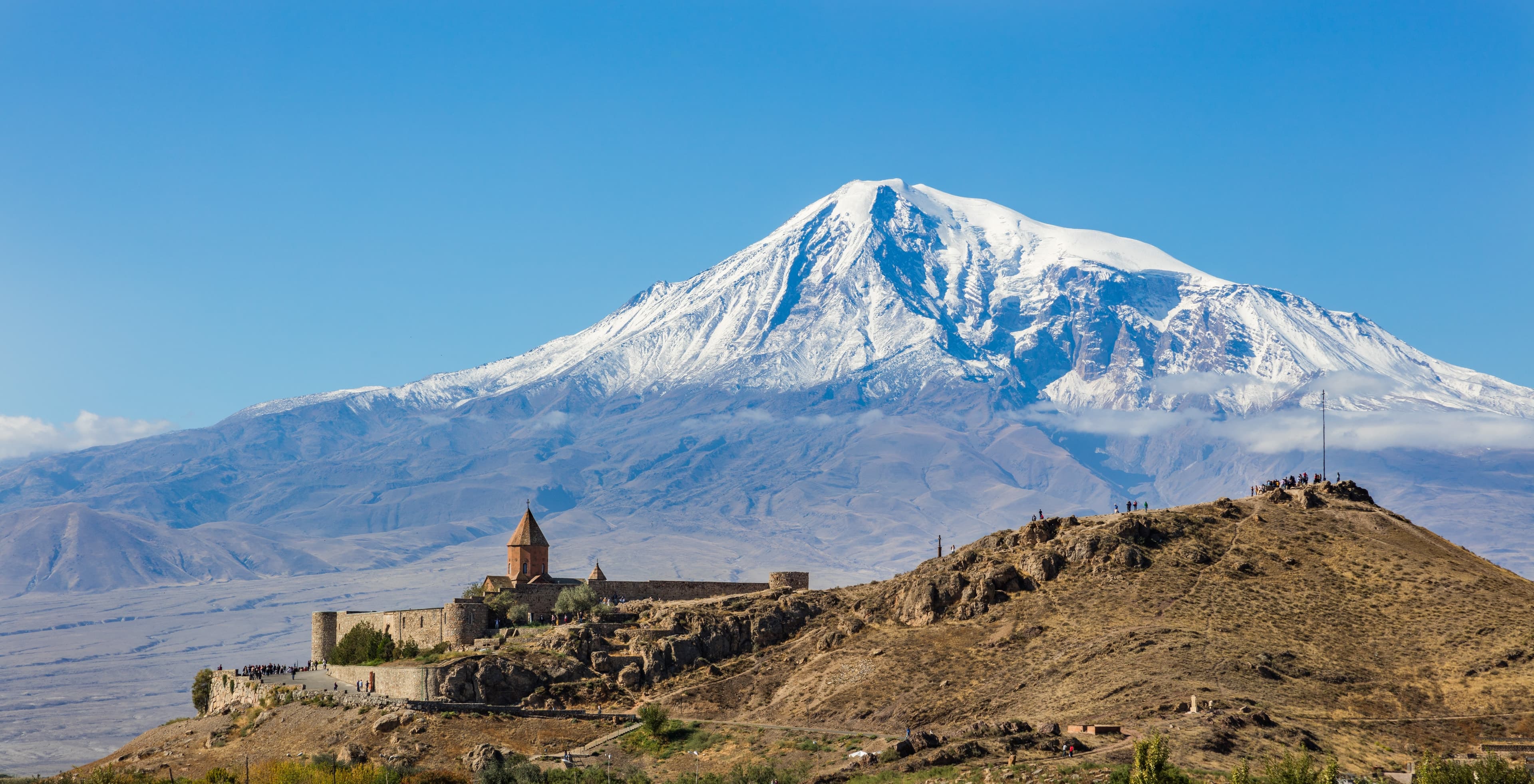
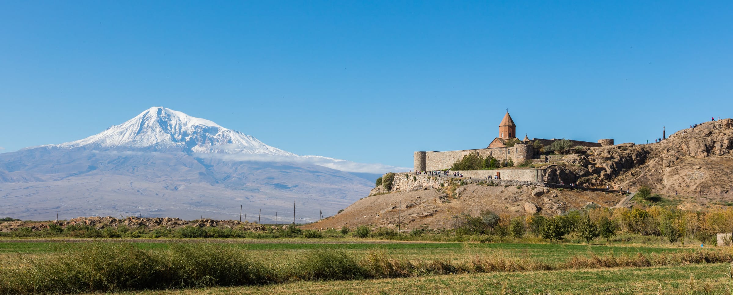
The dungeon of Khor Virap set against the Ararat panorama, followed by a detour into the quiet sandy semi-desert of Goravan.
Two hours and three turns: south on the M2 to the access road that runs dead straight at the monastery hill, then east across Vedi, and finally the way back along the foot of the Urtz ridge. From 990 metres in Yerevan it drops to 827 and climbs again to roughly 950 — the smallest spread in height of all five days. The last stretch into the reserve runs on firm field and sand track: level, with no gradient and no water to cross.
Driving time 2 h · Elevation 990 → 990 m
Red gorges, the monastery of Noravank and a wine tasting in the 6,100-year-old Areni-1 cave; overnight in the heart of Vayots Dzor.
Just under three hours and about 150 kilometres — the longest day of the trip and the only one that changes beds. Beyond the plain the M2 climbs to the watershed into Vayots Dzor and falls along the Arpa to Areni at 990 metres. From there it is two kilometres to the cave and back, then twelve kilometres of spur up to 1,591 metres: narrow between rock and streambed, tight in the bends, but sealed throughout. The evening ends at 1,194 metres in Yeghegnadzor.
150 km · Driving time 2 h 45 · Elevation 990 → 1,194 m
A leisurely drive back through the vineyards of Vayots Dzor to Yerevan, departure.
The same trunk road, taken the other way: 123 kilometres, two hours, not a metre of gravel. Against expectation the day opens with a climb, because Yeghegnadzor lies at 1,194 metres and the watershed ahead of it lies higher; only then does the road fall into the Ararat plain. Behind loaded lorries, overtake only with a clear view ahead. By midday you are back in Yerevan at 990 metres, which leaves time for an evening flight.
123 km · Driving time 2 h · Elevation 1,194 → 990 m
Ararat plainMonastery
Upper Azat valleyMonastery
Garni gorge, KotaykNature
VagharshapatMonastery
KotaykFortress
Vayots DzorMonastery
Packing list
Questions about this tour
Three reasons, and the first is the smallest: the two short unsealed stretches on days two and three. The second is seat height. Out over the Ararat plain it decides whether the mountain appears behind the poplar belt or not, and between the vine rows of Vayots Dzor you see over the walls. The third is reserve. Overtaking is constant on the M2, lorries grind uphill fully loaded, and one downpour in April or October turns the field track to the reserve into a different road for an hour. A high-riding vehicle is the calmer choice here, not the sportier one. What belongs on board is listed with the vehicles.
Because the goals of the first three days lie in three different directions and each is less than an hour of one-way driving away: Etchmiadzin to the west, Garni and Geghard to the east, Khor Virap and Goravan to the south. From one fixed base each direction makes a short day, whereas a loop would pay for the same kilometres with packing the case every morning. In practice that means only the day pack goes into the vehicle at breakfast, and the evening ends somewhere you already know your way around. Only day four moves on to Vayots Dzor — Areni and Noravank are too far for a day loop.
Better than any other in the programme, and the reason is the order things come in. If you have never moved a tall four-wheel drive, the first kilometres teach you the plain stuff: width, turning circle, braking distance, how the car sits in a crosswind out on the open plain. What the two unsealed stretches ask beyond that is set out in the section on surfaces. Driving yourself here mostly means your own pace on the trunk road and the freedom to stop where you like; route-finding stays with the guide vehicle, so navigation is not your job. Because the days are short, the wheel can be shared — sit and look in the morning, drive in the afternoon. And after every halt on loose ground, a glance at tyres and underbody belongs to the routine. What is covered at the start and what rides along is set out under safety standards.
The route runs from April to October; the mountain, by contrast, stands clear most reliably in the winter half of the year, when cold air presses the haze down over the plain. The two edges of the season are therefore the strongest weeks for day three: April and October bring clear mornings without the heat in the reserve becoming an issue. In July and August the haze often hangs on into the late afternoon and the sand heats up — then an early start pays twice over. Altitude plays no part in this: the route keeps to valley and plateau heights, and the one place that wants attention in the shoulder months is the M2 watershed between the plain and Vayots Dzor.
The two unsealed stretches: the Garni gorge and the sand at Goravan
Of five days, two short stretches leave the sealed surface, and both are easy. Below Garni a gravel track of one to two kilometres drops into the gorge; dry, it carries any vehicle, after rain water and clay stand in the ruts, and then ground clearance counts for more than drive. It is taken at walking pace, because oncoming traffic has nowhere to go in the tight bends. At Goravan the ground is not steep but soft: field track first, then sand. Where it turns loose, tyre pressure comes down so the contact patch grows — depending on load, to roughly one to one and a half bar — and goes back up afterwards. Add steady throttle, no steering at a standstill, no hard braking. The lead guide takes both stretches first and the convoy keeps its spacing; anyone who feels unsure hands over the wheel for those minutes. Low range is needed nowhere on this route.
Satellite communication on every route
Every group carries satellite messaging and tracking. Where the mobile network ends, the connection stays up, and help can be called from any point on the route.
Recovery gear and reserves on board
Winch, recovery straps, tools, spare fuel and spare water travel in every vehicle. In the convoy a second vehicle is always within reach, and the margin is planned before it is needed.
First aid and pre-planned routes to help
Comprehensive first-aid kits, guides trained in wilderness first aid, and routes to the nearest medical facility planned in advance for every stage.
Fixed dates or your own timing — guided or self-driven. We reply personally.