Off-road
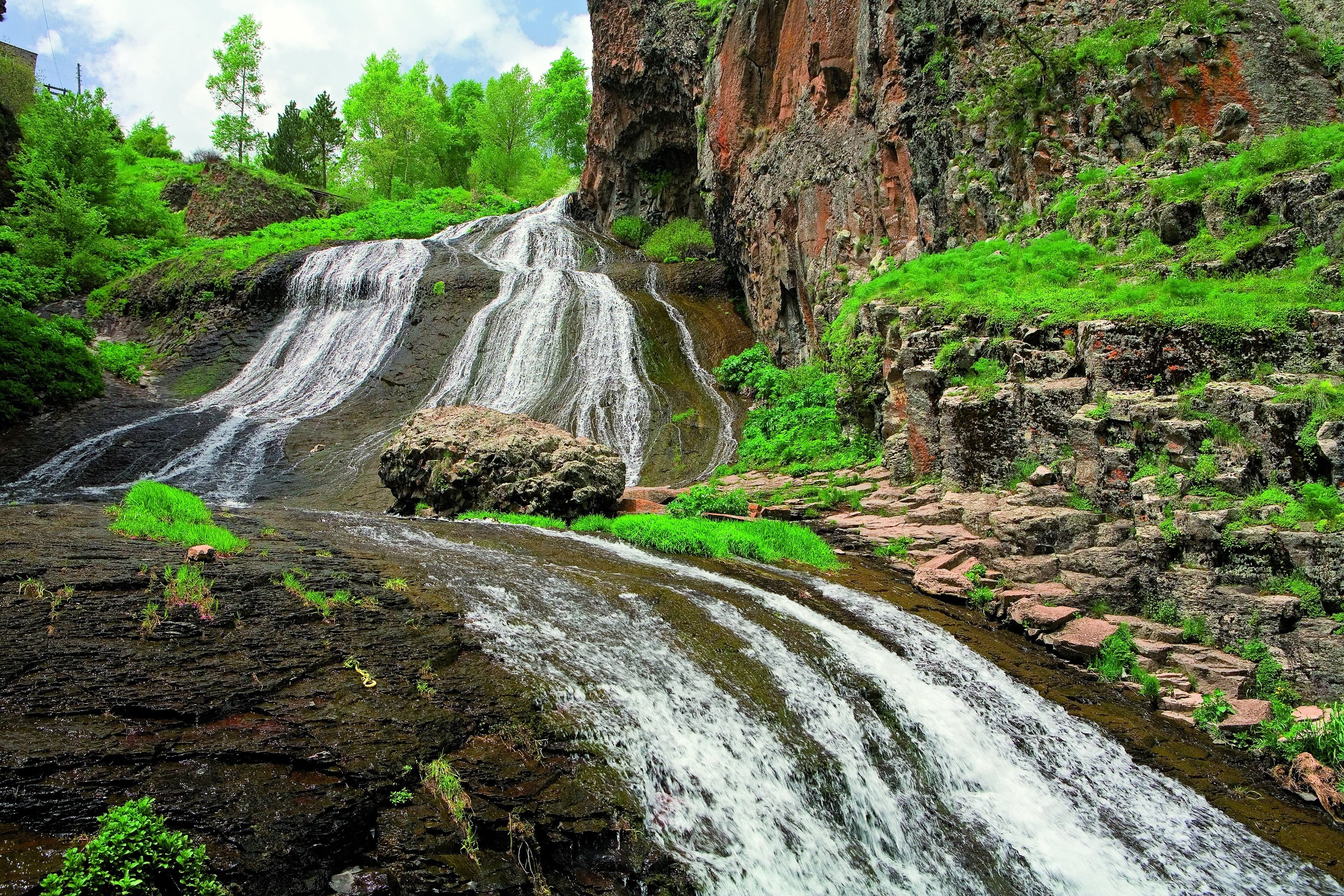
Jermuk, Vayots DzorGeyser
Jermuk, Vayots Dzor — Dormant volcanoes, steaming springs, ancient rock art
from$1,071per person, based on 5 guests
A tour for nature lovers: from the dormant volcanic cone of Hatis right at Yerevan’s doorstep, through the vineyards of Vayots Dzor to the bubbling geysers of Jermuk, on to the enigmatic stone rows of Karahunj and the Shaki waterfall, then a full day off-road up to the ancient petroglyphs of Ughtasar at 3,300 metres — before looping back over the historic Selim Pass with its Silk Road caravanserai, past Lake Sevan, to Yerevan. Nights are spent in cosy guesthouses with honest cooking.
This route has two summit days and three connecting days, and it opens with a volcano: the cone of Mount Hatis stands 2,528 metres high barely thirty kilometres east of Yerevan, near enough to sleep back in the city the same evening. After that the line runs south — Jermuk at 2,080 metres, Sisian at 1,600, and there the luggage stays put for two nights, because the day in between has no kilometres to spare for a change of bed. That day climbs to 3,300 metres, into the caldera above Ughtasar, and comes back down the same evening. Difficulty 3 of 5: two days are trunk road, two carry short hard pieces of terrain, and one is almost nothing but track.
The first day asks the fewest hours at the wheel and is still the dress rehearsal for everything that follows. Barely thirty kilometres of asphalt cross the Kotayk highland to the village of Kaputan, and there the surface ends. What comes next are gravel and earth tracks up into the pastures at the foot of the cone: unmade, scoured out in places, with stretches of loose rock in between. Low range, at least 22 centimetres of ground clearance and a lowered tyre pressure are not a recommendation here but a requirement; off-road factor 4 of 5. Above the meadows every wheel track stops — the cone itself is steep scree and rock steps and is climbed on foot, two to three hours to the top. After rain the loam on the lower sections softens and turns the same track into much heavier going.
The second part belongs to water. From Yerevan it is 123 kilometres of trunk road to Yeghegnadzor and a good fifty more up to the spa town; at its edge a track sets off towards the geysers, which lie at around 2,100 metres. What lies on it is coarse gravel with deeply cut channels, plus several drives through streams and one river, at their fullest in early summer — factor 4 of 5, and the wheel track runs right up to the spring. The next day the road drops out of Jermuk into the valley, swings east, crosses a pass of 2,344 metres on the border of two provinces and sinks to the 1,600 metres of Sisian. From there the stone rows of Zorats Karer are four kilometres of made-up approach away, the Shaki waterfall seven, with a few hundred metres of gravel at the end.
The fourth day is the reason this tour is run as an expedition. Out of Ishkhanasar a highland track rises over seventeen kilometres by some 1,400 metres into the caldera at 3,300 metres: loose scree, rock steps, meltwater fords, and patches of snow up top well into the summer. Off-road factor 5 of 5, and nobody drives it with a single vehicle. It is dependably open from mid-July to the end of August, and with luck into September; if your dates fall earlier or later within the June-to-October season, an adapted stage around Sisian takes its place. Day five is then the way home over two passes: the 2,344 metres once more, then the bends up to the Vardenyats pass at 2,410 metres, with the Selim caravanserai standing just below the top of it, after that down to Lake Sevan at 1,900 and the last sixty-odd kilometres to Yerevan. Your bed follows the comfort class rather than the place: Signature means a spa hotel, Expedition a guesthouse, Frontier a wild camp. Drive yourself and you have the lead guide in front of you on the two track days; the rest of the distance you cover alone.
Right at Yerevan’s doorstep waits the dormant volcanic cone of Hatis: gravel tracks climb to the alpine meadows at its base, while the steep final scramble over loose scree is on foot only — a volcanic opening chapter with views across the Kotayk highlands.
An hour and a half of actual driving and a full day all the same: barely thirty kilometres of asphalt eastwards across the Kotayk highland, then the gravel and earth tracks up into the pastures at the foot of the cone — whatever they take comes on top of that figure. There the wheel track ends; the last metres of ascent over scree and rock steps belong to your legs, two to three hours up to 2,528 metres. In the evening the same road back to the city.
Driving time 1 h 30 · Elevation 990 → 990 m
A drive through the vineyards of Vayots Dzor to the spa town of Jermuk, set above 2,000 metres — just outside town, in open highland, warm mineral water bursts from one of 44 geysers every two to seven minutes, wrapping us in steam.
The long swing south: 123 kilometres of trunk road to Yeghegnadzor, a good fifty more up to Jermuk, three hours at the wheel together. Beyond Vayk the road to the spa town branches off and gains height steadily to 2,080 metres. Late in the afternoon comes the short hard piece: the track up onto the plateau, where the geysers sit at around 2,100 metres — short, but the only piece of the day that demands real technique. The night is spent in Jermuk.
Driving time 3 h · Elevation 990 → 2,080 m · highest point 2,100 m
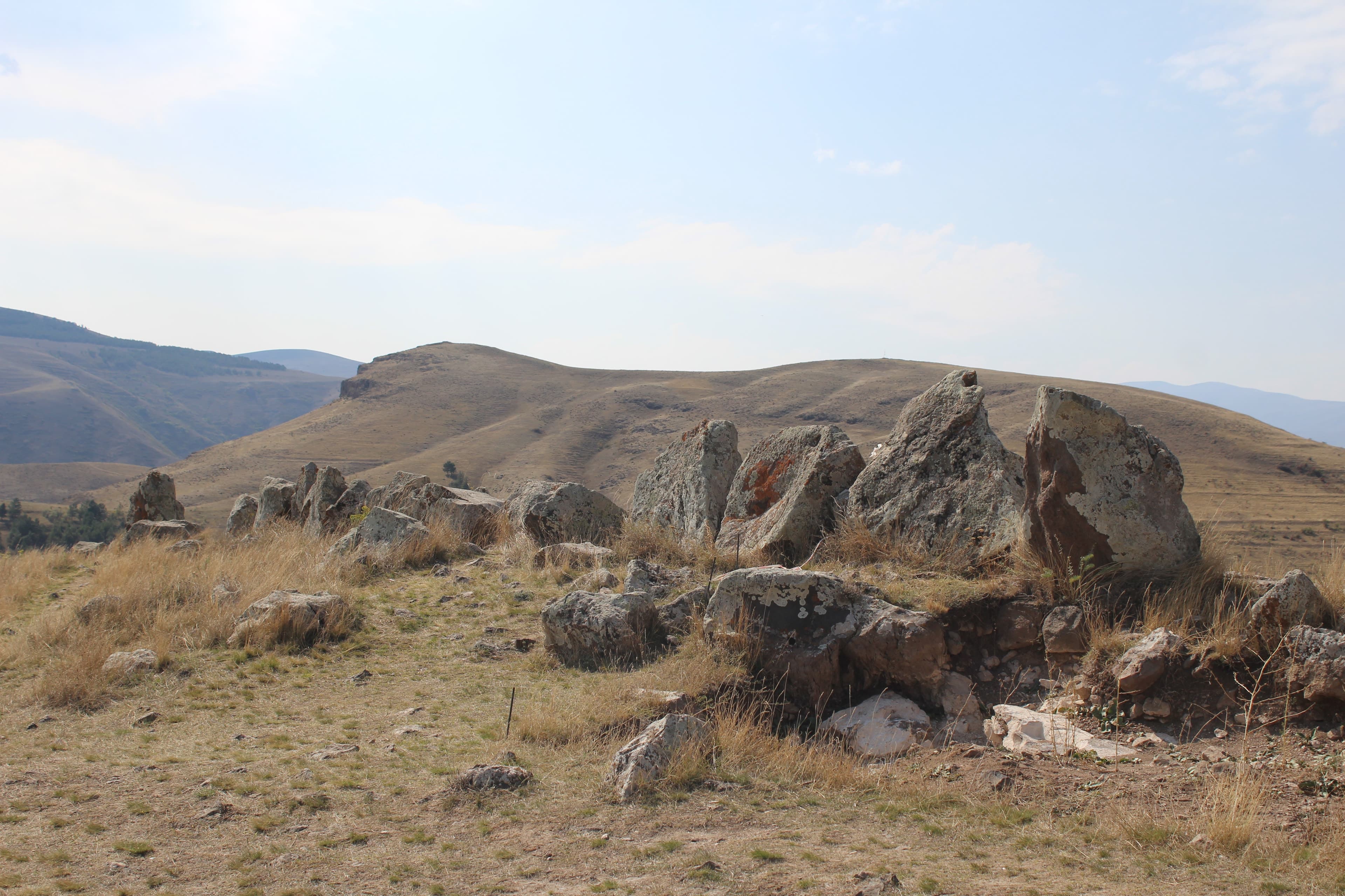
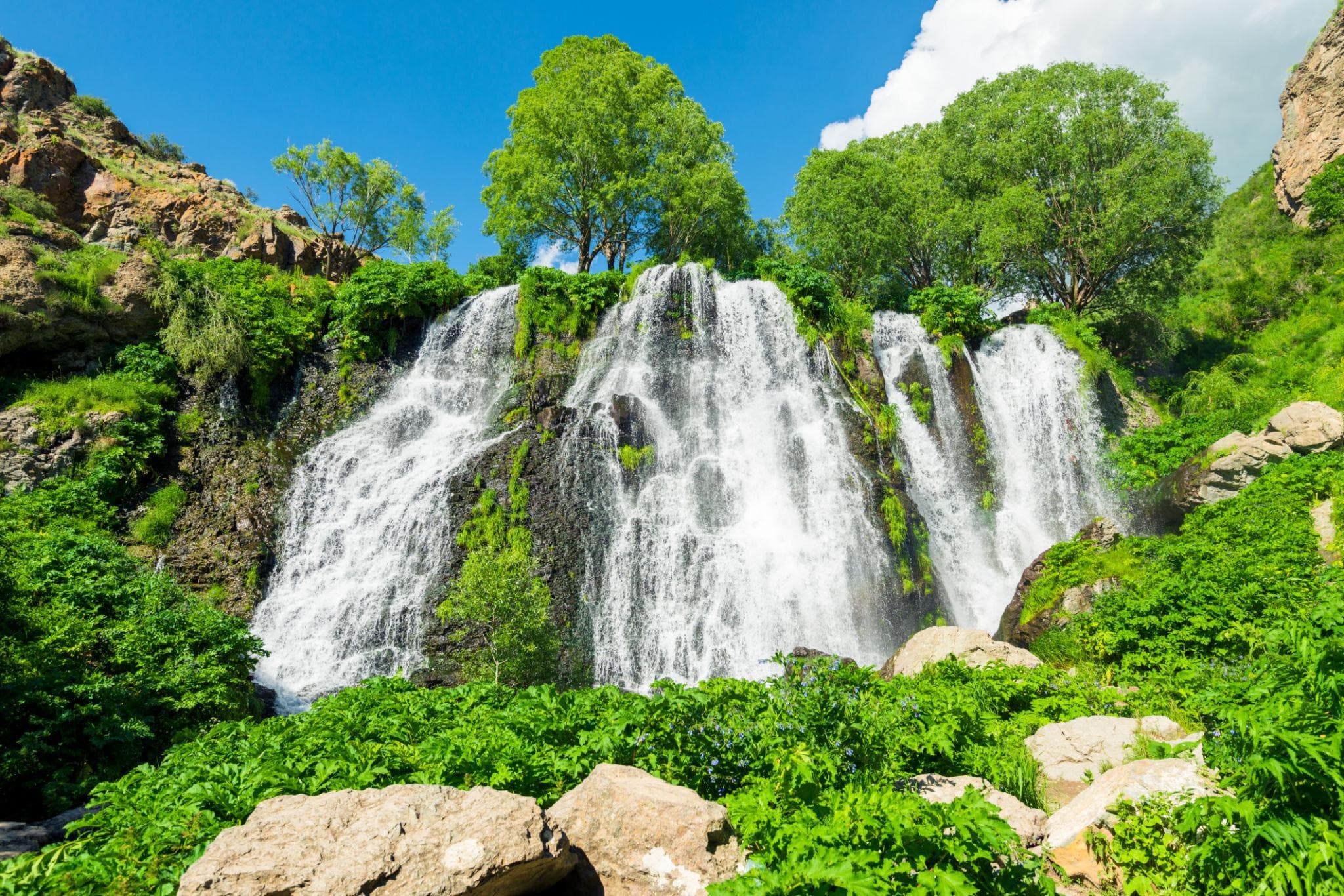
Via Sisian to the pierced stone rows of Zorats Karer, the “Armenian Stonehenge” at 1,770 metres, then on to the 18-metre veil of the Shaki waterfall.
A hundred and eight kilometres, a good two hours: eighty-six of them from Jermuk to Sisian, over the pass on the provincial boundary and down to the turning just short of town. The rest of the day plays out within seven kilometres — four made-up ones up to the stone field at 1,770 metres, seven to the waterfall, whose eighteen-metre basalt ledge waits behind a few hundred metres of gravel. Night at 1,600 metres.
108 km · Driving time 2 h 15 · Elevation 2,080 → 1,600 m · highest point 2,344 m · tarmac 99 % / gravel 1 %
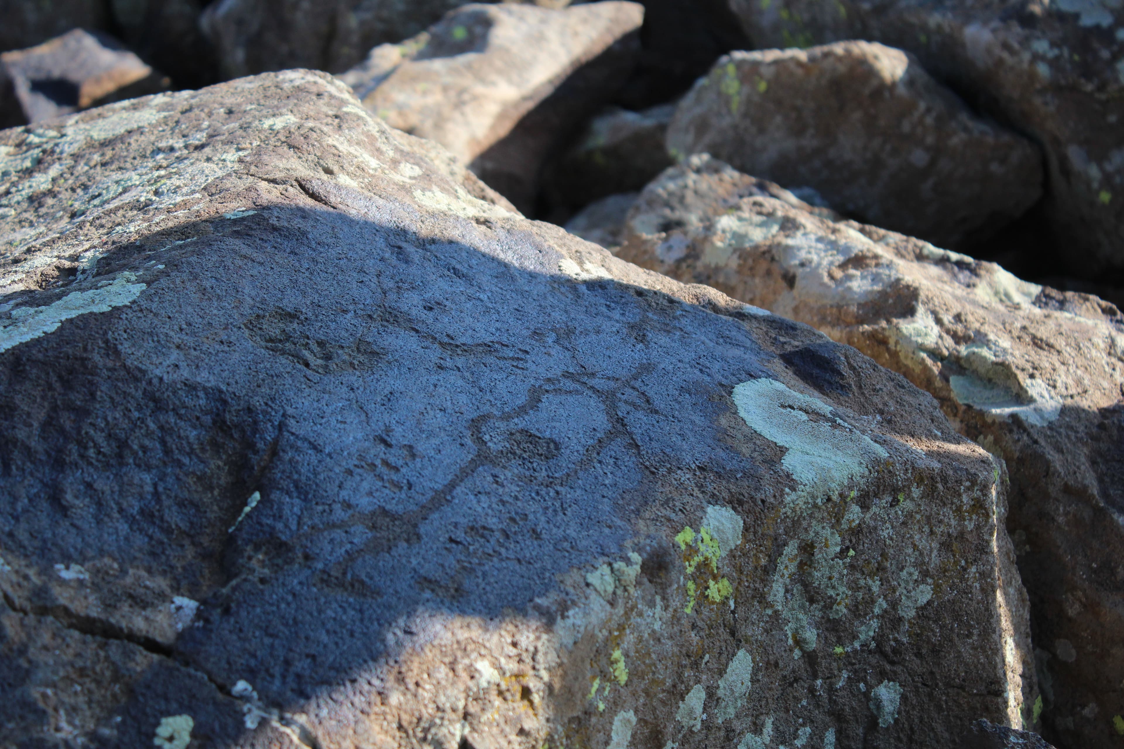
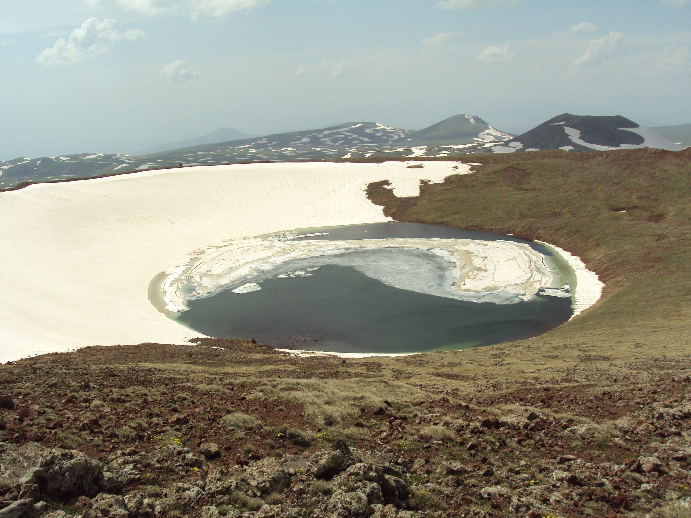
A full day off-road, climbing to 3,300 metres and the petroglyphs of Ughtasar: ibex, hunters and celestial symbols, pecked into the rock by shepherds millennia ago.
Four hours of actual driving, and every one of them counts double: two hours up, two down, and the caldera at 3,300 metres in between. From Ishkhanasar it is seventeen kilometres of track with some 1,400 metres of ascent over scree, rock steps and meltwater fords; higher up, snowfields hold on into high summer. An early start, so the afternoon weather is not yet sitting over the basin. Back in Sisian in the evening, in the same lodging as the night before.
Driving time 4 h · Elevation 1,600 → 1,600 m · highest point 3,300 m
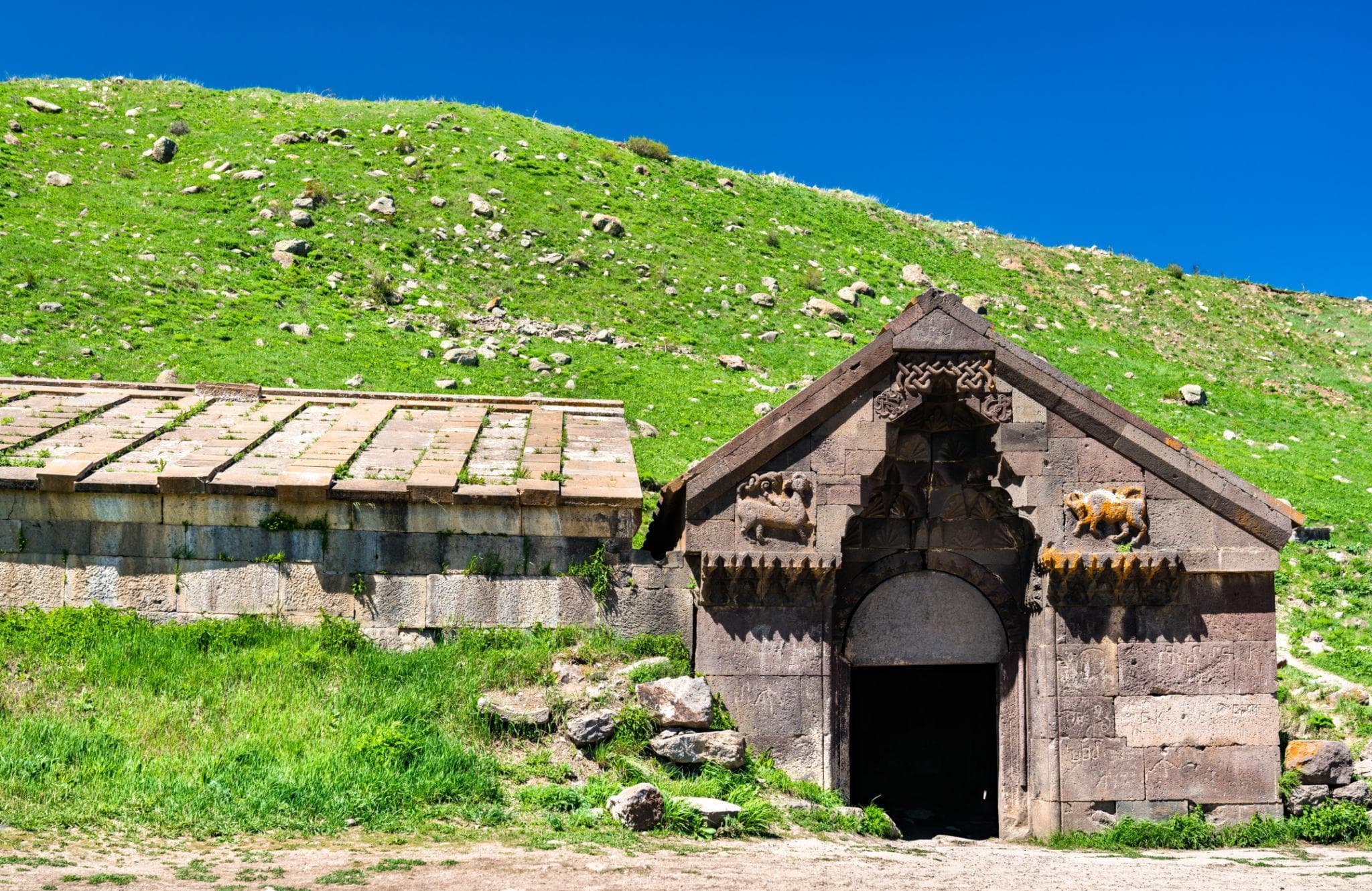
The drive back via Yeghegnadzor and the historic Selim Pass with its Silk Road caravanserai, past Lake Sevan and on to Yerevan, departure.
Two hundred and seventy-three kilometres, a good four hours, all of it sealed and still no rest day: first eighty-eight kilometres west over the pass on the provincial boundary to Yeghegnadzor, then thirty-two kilometres of bends up to the Vardenyats pass at 2,410 metres, the caravanserai standing just below its top. Potholes and frost damage come with it, and fog in the curves even in summer. The northern ramp falls to Lake Sevan, and from there it is sixty-odd kilometres to Yerevan.
273 km · Driving time 4 h 15 · Elevation 1,600 → 990 m · highest point 2,410 m · tarmac 100 %
Jermuk, Vayots DzorGeyser
near Sisian, SyunikArchaeology
near Sisian, SyunikNature
KotaykMountain
SyunikArchaeology
Vayots DzorCaravanserai
Packing list
Questions about this tour
Then the fourth day is rebuilt. The Ughtasar rock art lies in a caldera at 3,300 metres that stands under snow for most of the year; the approach is dependably driveable from mid-July to the end of August, with some luck on into September. The tour itself runs from June to October. If your dates fall outside that narrower window, you get an adapted off-road stage around Sisian in place of the caldera, settled when you enquire — rather than an approach that ends at a snowfield.
Up into the pastures at the foot of the cone. The tracks that lead there are the real piece of driving on the first day: scoured, strewn with loose rock, factor 4 of 5, and the vehicles need low range and ground clearance for it. The cone of Mount Hatis itself cannot be driven — above the edge of the meadows scree and rock steps begin, and the top at 2,528 metres is climbed in two to three hours. Prefer to stay below and the pastures give you time and a view; the day works either way.
Noticeably, but it stays manageable, because you do not sleep up there. The first night is in Yerevan, the three that follow lie between 1,600 and 2,080 metres, and the altitude of the fourth day is limited to a few hours. Even so, up there the rule is: walk more slowly than the ground suggests, drink plenty, put on a layer as soon as the wind picks up. Anyone who notices a headache or nausea says so at once — the answer to that is to descend, and the descent starts from wherever you happen to be standing.
Because the fourth day runs out and back and has no destination at the far end. Four hours of actual driving sit in the track itself, plus the time up in the basin; a change of lodging in the evening would add an hour of trunk road to an already long day. So the luggage stays, the vehicle climbs lighter, and in the evening you come back to a place you already know. It is also the only point in these five days where the same bed waits twice in a row.
Snowfields and fords on the way to the caldera
The fourth day stands on its own. Seventeen kilometres gain some 1,400 metres of height, and the way up is made of three things: loose scree that travels under the wheels, rock steps taken at walking pace, and meltwater fords whose level is lower in the morning than in the afternoon. Every ford is walked first, every step looked at first. Higher up, snowfields lie across the line into high summer; whether one still bears is settled on the spot and not the evening before. Nobody drives this with a single vehicle, then: the group goes in line, leaving space between vehicles, the lead guide out front. At 3,300 metres the air is thin: up there you move more slowly than you would like.
Satellite communication on every route
Every group carries satellite messaging and tracking. Where the mobile network ends, the connection stays up, and help can be called from any point on the route.
Recovery gear and reserves on board
Winch, recovery straps, tools, spare fuel and spare water travel in every vehicle. In the convoy a second vehicle is always within reach, and the margin is planned before it is needed.
First aid and pre-planned routes to help
Comprehensive first-aid kits, guides trained in wilderness first aid, and routes to the nearest medical facility planned in advance for every stage.
Fixed dates or your own timing — guided or self-driven. We reply personally.