Paved
Vayots DzorMonastery
Vayots Dzor — A wine cave, red cliffs and hot springs — in two days
from$477per person, based on 5 guests
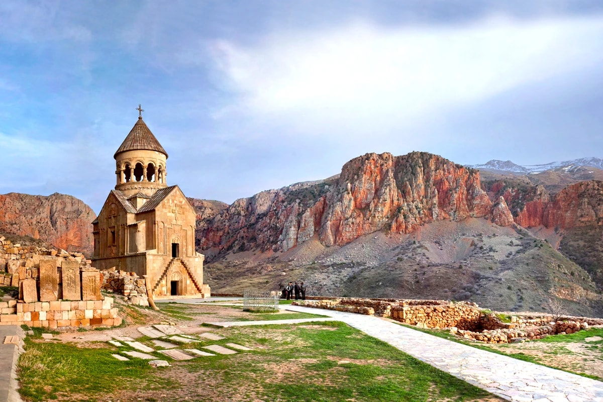
The connoisseur’s short route: we taste Areni Noir in the 6,100-year-old Areni-1 cave, climb to the honey-red monastery of Noravank set against its glowing cliffs, then follow the Arpa river to the quiet monastery of Gndevank before evening falls on the spa town of Jermuk. On the second morning, bubbling mineral geysers await high above the town, followed by an easy drive back to Yerevan. Wine, rock and hot spring water, concentrated into two days without a single wasted detour — with an overnight stay at a spa hotel.
Two days, a little over 400 kilometres, and nearly all of it sealed road: this route is where driving in southern Armenia begins, not where it is tested. It starts in Yerevan at around 990 metres, drops along the M2 into the Ararat plain to 810 metres at Yeraskh, turns east there and then works its way up through tightening hills to the saddle that separates Ararat province from Vayots Dzor. Beyond that saddle sits Yelpin at 1,545 metres, and the road runs downhill beside the Arpa to Areni. From there the river is the thread the whole tour follows: Areni just under 1,000 metres, Yeghegnadzor at 1,194, Vayk at 1,300, Jermuk at 2,080. Between the start and the night’s lodging that makes just under 1,100 metres of net gain, spread over a trunk road that is sealed the whole way.
Terrain in the narrow sense turns up twice, and both stretches are short. The first is the approach to Gndevank Monastery: a spur leaves the Vayk–Jermuk road and drops towards the bank of the Arpa, the surface alternating between asphalt and packed gravel. Dry, any car manages it; after rain the gravel softens, and ground clearance and four-wheel drive become the difference between brisk and careful. The second stretch is the reason this tour is driven in a 4x4 at all: the track from the edge of Jermuk up to the geysers at a shade over 2,100 metres. Loose gravel, washouts, several fords through streams that carry meltwater in spring. This is where low range earns its keep, tyre pressure comes down, and the track carries on all the way to the warm spring.
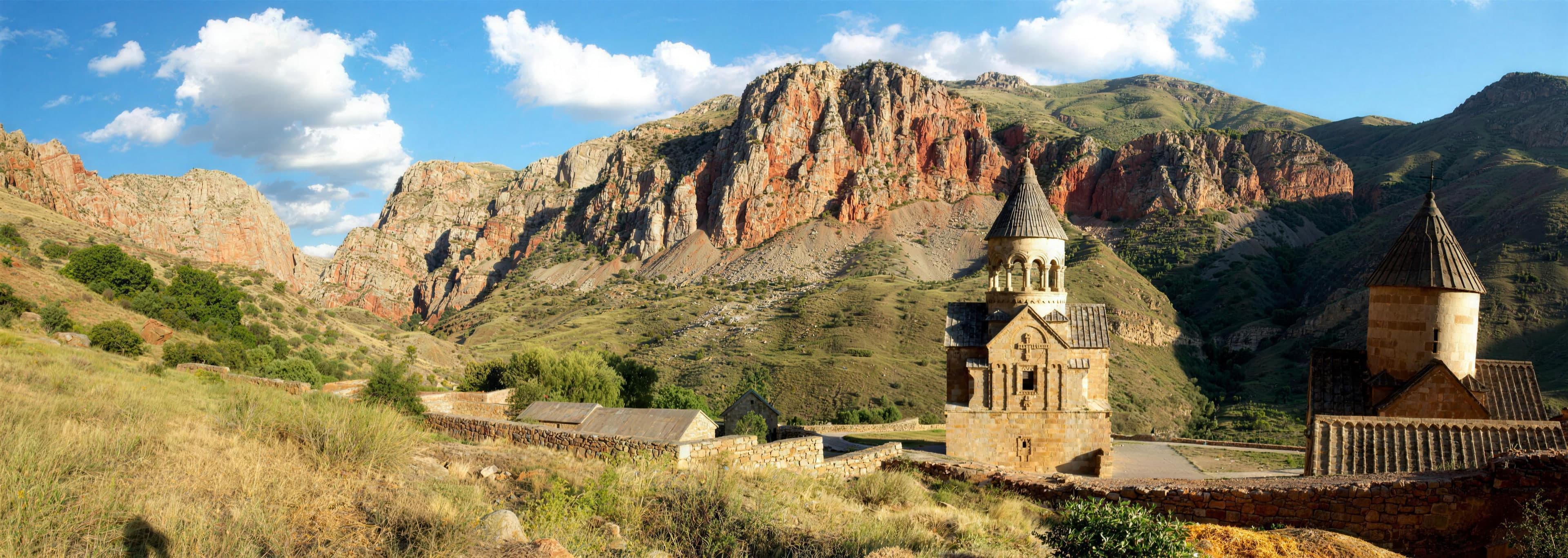
The spur to Noravank Monastery, by contrast, is twelve kilometres of asphalt laid tight into the Amaghu gorge, ending at roughly 1,590 metres. It is narrow rather than hard; whoever holds the wheel keeps an eye on the bends rather than on the red rock. The Areni-1 cave sits right on the M2, one kilometre east of Areni, with roadside parking and a few minutes on foot. The rhythm of the days follows from that: on day one just under four hours of actual driving over some 200 kilometres, with three stops of half an hour to an hour each and the wine tasting in between; on day two the geysers come first thing — the track up and back down is short but technical, with as much time at the warm water in between as the group wants — after which about three hours of driving bring you back, with one break in the Arpa valley.
Guided, the group travels in convoy, the lead guide setting the pace and taking the track to the geysers first. Self-drive on this route means handling the sealed stages on your own and following the guide vehicle through the off-road section, in low range and with tyre pressure lowered, the way the off-road training at the start explains it. Accommodation follows the comfort class, not the place: in Jermuk a hotel with a spa in the Signature class, a guesthouse in the Expedition class, a wild camp above the town in the Frontier class. The season runs from June to October; the track to the geysers is clear from about May, and anyone who wants the fords at low water lets the snowmelt run off first.
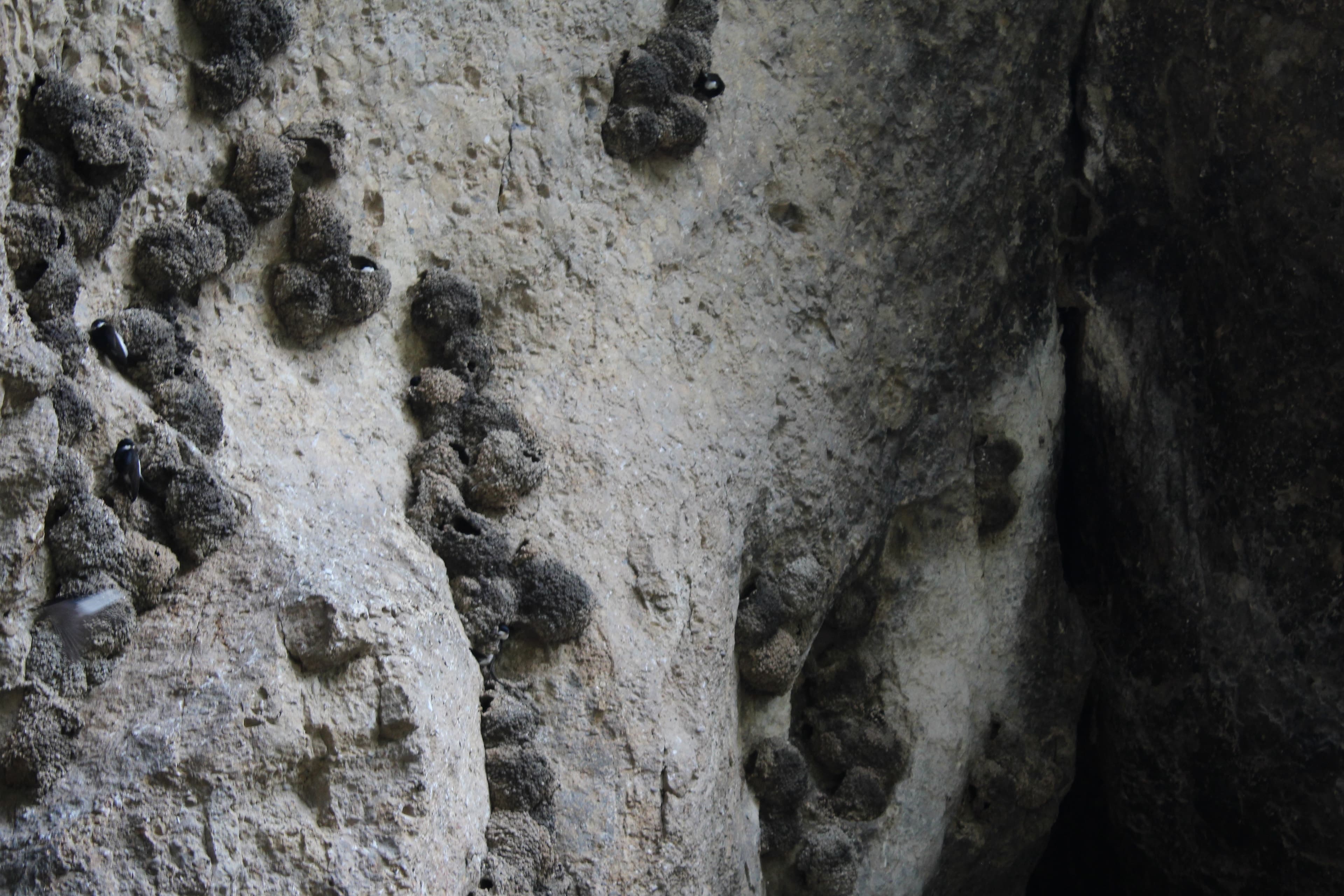
A wine tasting in the ancient Areni-1 cave, then up to Noravank Monastery set against its honey-red cliffs, and on along the Arpa river to the quiet monastery of Gndevank; overnight in the spa town of Jermuk.
Around 210 kilometres and just under four hours at the wheel. Flat as far as Yeraskh, then the climb to the watershed and the run down into the Arpa valley, all sealed. The detour to Noravank uses a narrow but well-kept gorge road, 24 kilometres there and back. Beyond Vayk the H-42 winds up onto the plateau of Jermuk; the spur to Gndevank is the day’s only gravel, short and harmless when dry. Arrival in Jermuk at 2,080 metres, where the evening air is noticeably cooler than down below.
210 km · Driving time 3 h 45 · Elevation 990 → 2,080 m · tarmac 99 % / gravel 1 %
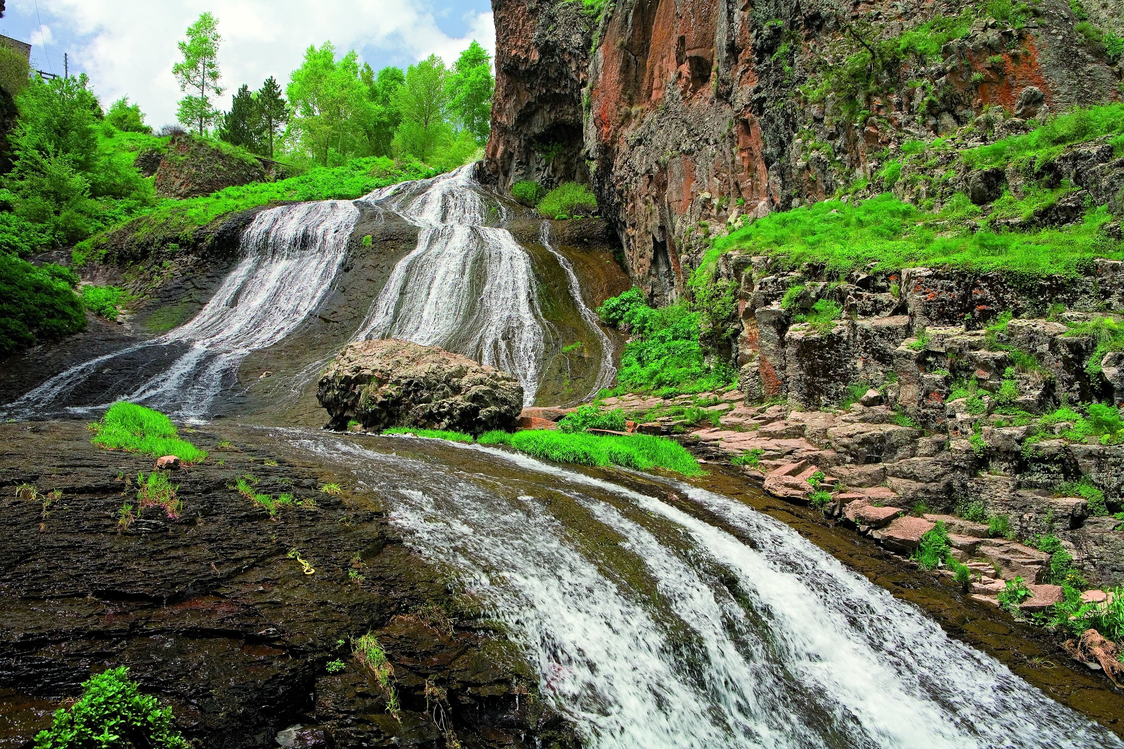
A morning among the bubbling mineral geysers high above Jermuk, then an easy drive back via Yeghegnadzor to Yerevan.
The morning belongs to the track: past the mineral water plant at the edge of town, over loose gravel and washouts onto the high plateau, low range engaged, tyre pressure lowered, several fords the guide checks on foot beforehand. Highest point of the tour at about 2,140 metres, and the track ends at the spring itself. Back in Jermuk the tyres are reinflated, then 170 kilometres of asphalt via Vayk and Yeghegnadzor to Yerevan, roughly three hours with one break in the Arpa valley.
Driving time 3 h · Elevation 2,080 → 990 m · highest point 2,140 m
Vayots DzorMonastery
Areni, Vayots DzorWine
Jermuk, Vayots DzorGeyser
Vayots DzorMonastery
Packing list
Questions about this tour
Yes. Apart from the track to the geysers everything is sealed, and the gorge road to Noravank only asks for attention in the bends. You take the off-road section behind the guide vehicle, after a briefing on low range, tyre pressure and fords on the morning of the second day. A vehicle with four-wheel drive and low range is the condition for that; an ordinary car reaches Jermuk and goes no further.
That depends on the season. In spring the streams on the plateau carry meltwater and the levels stand high; later in the summer they are usually shallow crossings over firm ground. There is no fixed date in the calendar for the change — the winter before decides it. The guide walks every ford before the first vehicle enters it, and whether it is driven at high water is settled there on the bank, not on a desk beforehand.
On the first day just under four hours of actual driving over around 210 kilometres, plus three stops and the wine tasting, which together take roughly as long. The second morning belongs to the geysers: the track up and back down is short but calls for low range and lowered tyre pressure, and how long you stay at the warm water is up to the group. After that about three hours back to Yerevan with one break. Leave out the detour to the geysers and you are back in the city in the early afternoon.
The monasteries, the cave and Jermuk itself can be reached all year round. What is missing is the geysers: the track is open from roughly May to October, before that snow lies on the plateau, and in winter ice can sit on the road through the Amaghu gorge. Outside the season we drive the route on an adjusted line without the off-road section, with more time in Jermuk.
Gravel and fords above Jermuk
The only real off-road section is the track to the geysers: loose gravel, washouts and several fords that rise with the snowmelt. The lead guide walks every ford before the first vehicle enters it, the convoy crosses one car at a time, and whether a crossing is driven at a high level is the guide’s decision there and then.
Satellite communication on every route
Every group carries satellite messaging and tracking. Where the mobile network ends, the connection stays up, and help can be called from any point on the route.
Recovery gear and reserves on board
Winch, recovery straps, tools, spare fuel and spare water travel in every vehicle. In the convoy a second vehicle is always within reach, and the margin is planned before it is needed.
First aid and pre-planned routes to help
Comprehensive first-aid kits, guides trained in wilderness first aid, and routes to the nearest medical facility planned in advance for every stage.
Fixed dates or your own timing — guided or self-driven. We reply personally.