Off-road
GegharkunikLake
Gegharkunik — Climbing to the crater lake on the dragon peak, 3,597 metres up
from$212per person, based on 5 guests
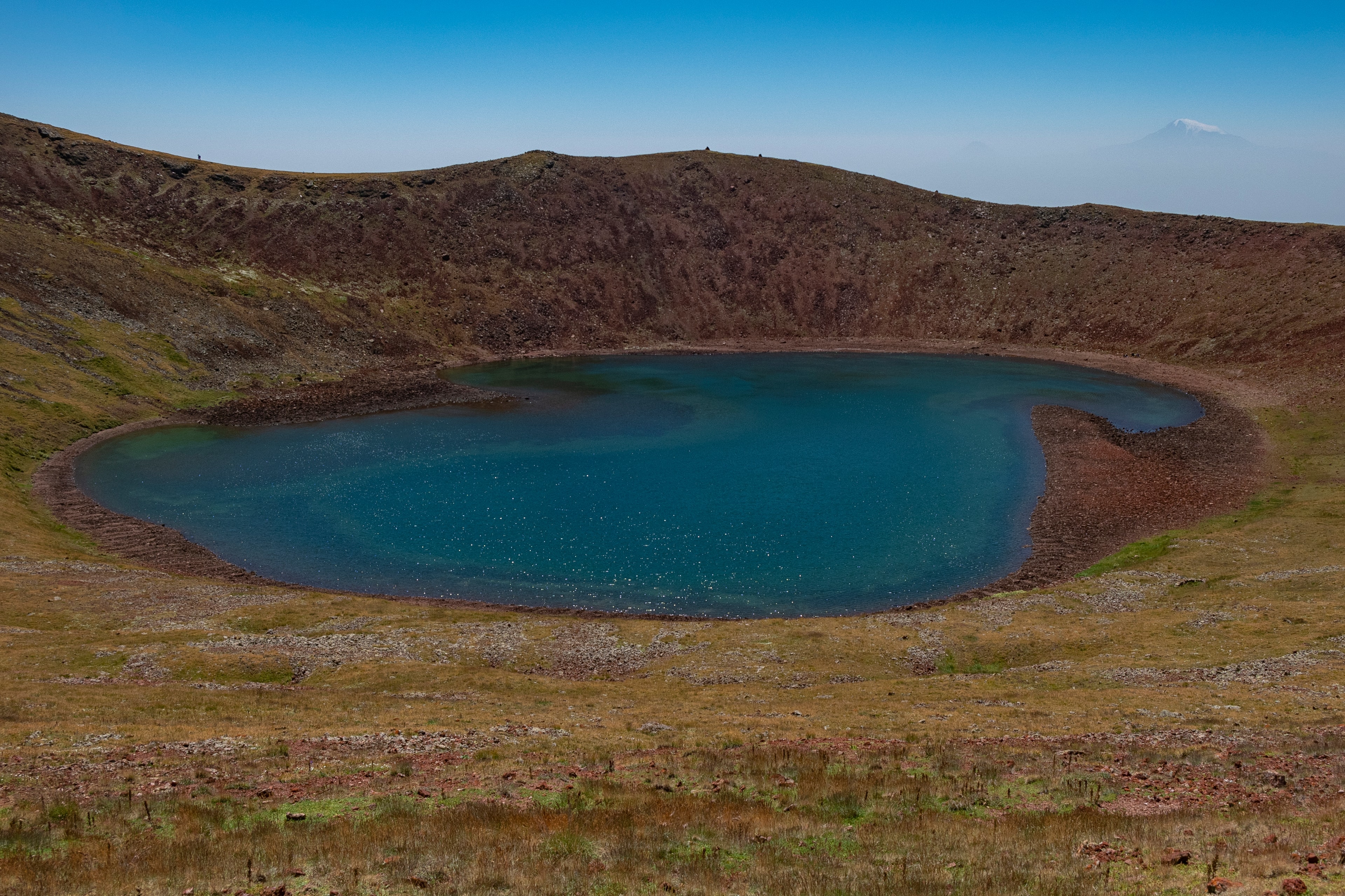
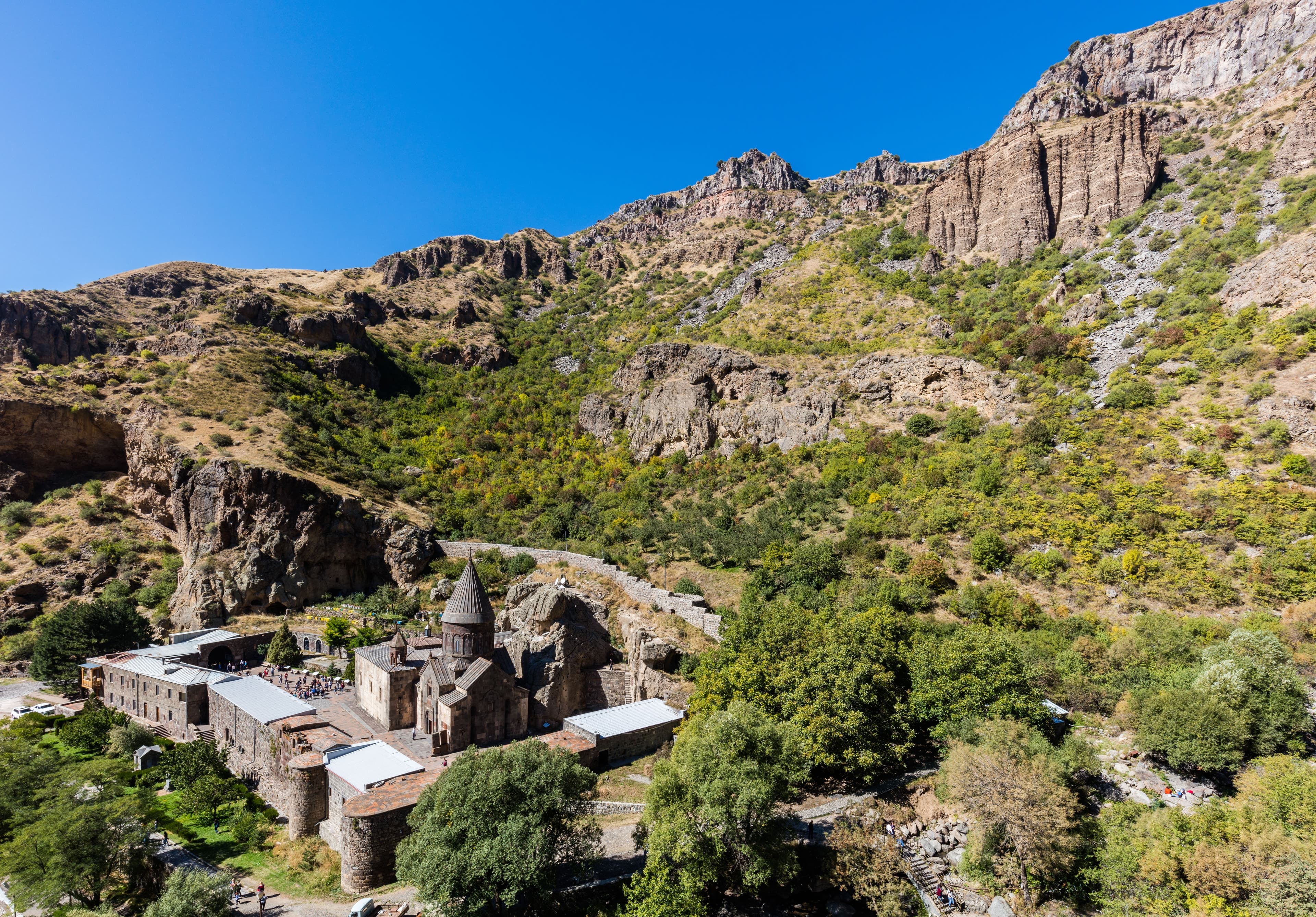
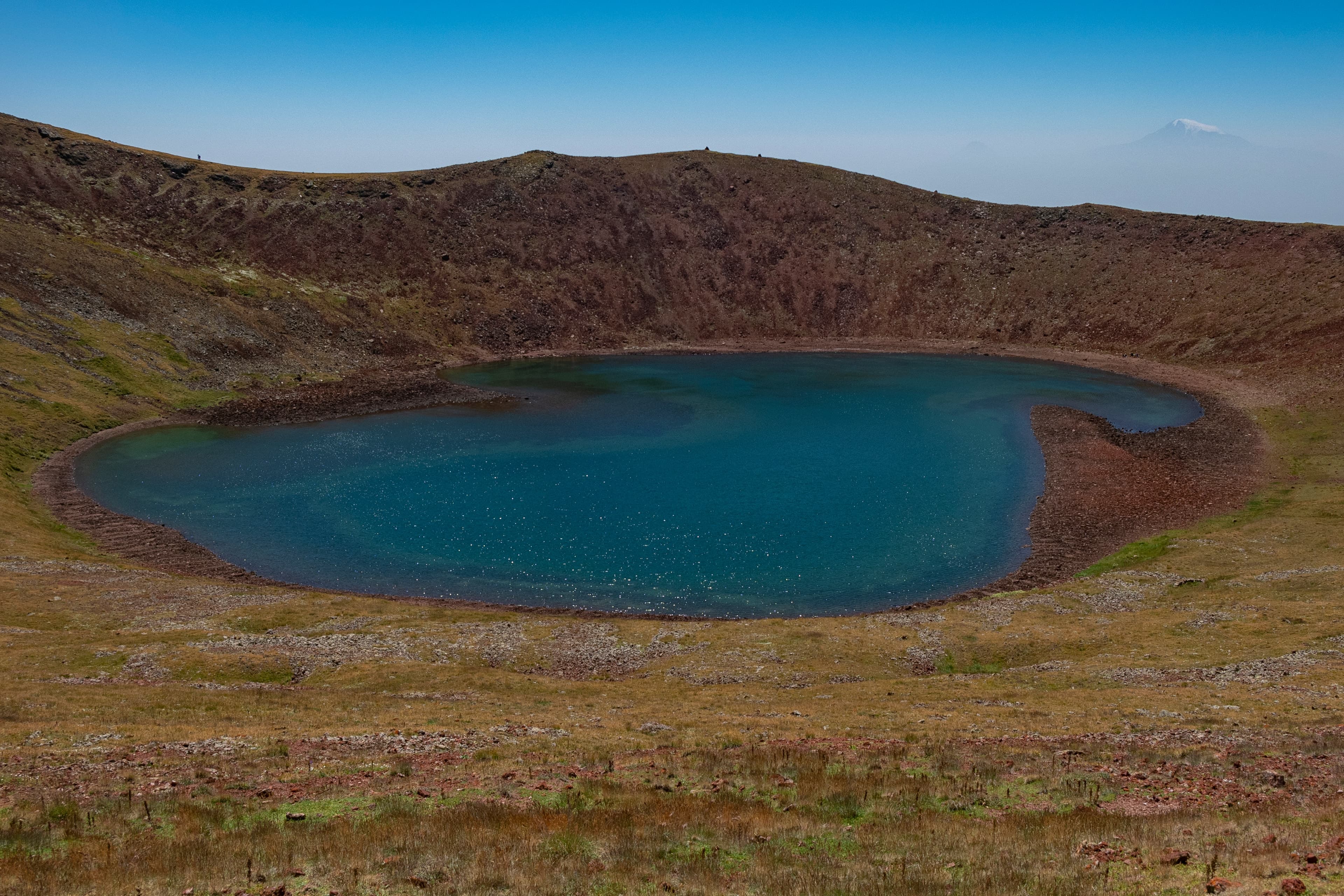
The most demanding day trip in our programme: we leave Yerevan early and drive out past Geghard Monastery, to where the asphalt ends. From there a rough highland track climbs over grass steppe, scree and cooled lava fields past 3,000 metres — with stream fords that swell depending on the snowmelt. We cover the final stretch to the crater rim of Mount Azhdahak, at 3,597 metres the highest peak of the Geghama range, on foot: 30 to 60 minutes up a loose cinder slope. At the top lies a still, cold lake inside the extinct crater, watched over by Bronze Age dragon stones, while more than 12,000 petroglyphs are pecked into the surrounding rock. The mountain carries the name of a dragon from ancient Armenian legend — the view reaches to Lake Sevan and, on a clear day, to Mount Ararat. A long, demanding day for fit adventurers with sturdy boots; we’re back in Yerevan by evening.
At the car park below Geghard Monastery, 1,800 metres up, the sealed surface stops, and everything behind it is track: a good two hours to the foot of a volcanic cone. Before that come just under forty kilometres of asphalt, out of Yerevan at around 990 metres, east and up the Azat valley — and in the evening the same forty again the other way. That is how the day divides: a little under half the distance on sealed road, the rest on a highland track that works across the flanks of Mount Paytasar onto the Geghama plateau and almost never levels out. Between the city and the end of the track lie some 2,200 metres of climb, all of it worked off in a single morning. On a map 170 kilometres look like half a day; in the vehicle they turn into six hours at the wheel, more than four of them on the track.
Up there the ground is made of two things, pasture grass and basalt. The line runs over mats of grass, crosses fields of cooled lava where single blocks stand proud of the ruts, and climbs ramps of coarse gravel in between. Streams cut across it; how deep they stand depends on how much snow the winter left on the plateau. Low range is not the exception on this route but the default, tyre pressure comes down before the first steep pitch, and in every second bend ground clearance decides whether a block is driven around or driven over. Off-road factor 4 of 5, and that four speaks less of steepness than of duration: between Geghard and the foot of the cone there is no section that drives itself.
The track ends at about 3,200 metres, where the scoria cone of Mount Azhdahak begins. The crater rim at 3,597 metres is entered on foot, the way a monastery staircase is climbed: a good half hour upwards, a full one at an easy pace, over cinder that gives under the sole. At the top the crater opens, half a kilometre across and fifty metres deep, with the lake on its floor. The group travels in convoy behind the lead guide, six guests at most; our vehicles carry low range, differential locks and the recovery gear. Drive yourself and the sealed road to Geghard is yours alone; on the track you follow the lead vehicle. The season runs from June to October.
From Yerevan out past Geghard Monastery onto the highland track: grass steppe, scree and cooled lava fields climbing past 3,000 metres, then on foot up to the crater rim of Mount Azhdahak and its still crater lake. Return by the same track via Geghard to Yerevan.
Six hours of actual driving over 170 kilometres, just under forty of them sealed, out and back: from Yerevan up the Azat valley to Geghard, then track. The line climbs over mats of grass and fields of lava onto the plateau, crosses streams whose level rises with the snowmelt, and ends at about 3,200 metres at the foot of the scoria cone. That is where the vehicle stays; the crater rim itself is climbed. The way back uses the same line, which spreads the driving time almost evenly across morning and afternoon. One halt is fixed, Geghard on the way out; everything beyond that follows the weather and the snow. Early evening brings the group back into town.
170 km · Driving time 6 h · Elevation 990 → 990 m · highest point 3,200 m · tarmac 47 % / track 53 %
GegharkunikLake
Upper Azat valleyMonastery
Packing list
Questions about this tour
The vehicle reaches the foot of the cone, some 3,200 metres up. From there just under four hundred metres of climb remain to the rim at 3,597, thirty to sixty minutes depending on your pace. The slope is loose cinder, every step slides back a little, and poles do more for you than hurry. At the top the lake lies deep in the crater; the way down to its shore is just as steep again, and whether you take it is your own call. Anyone who would rather stay below waits at the vehicle: the view across the plateau already carries far from there, and the cone gives shelter from the wind.
Yes, though not as your first time off road. Four out of five on the difficulty scale does not mean extreme obstacles here; it means a good four hours in which the route never lets up, with blocks, ramps and fords following one another without pause. Self-drivers get the off-road training at the start and take the track in convoy behind the lead vehicle, which sets the line and checks the fords. As far as the monastery the surface makes no particular demands. The condition is a vehicle with four-wheel drive, low range and real ground clearance; anything less stays parked at Geghard.
Because the arithmetic is tight. Six hours in the vehicle, one to two hours up at the crater, the halt at Geghard and a break on the plateau — that fills a long day with nothing left over. Departure from Yerevan is before sunrise, the vehicle stands at the foot of the cone mid-morning, and the way back follows the same line you drove up in the morning. By evening you are in the city again, not by mid-afternoon. If the climb is dropped, the day does not get shorter for it: there is simply more time on the plateau and at Geghard.
Basalt, snowfields and storms above 3,000 metres
The plateau is open ground with nothing to hide behind. Basalt blocks sit in the ruts, snow holds in the hollows into June, and storms build over the cones suddenly and without warning — lightning, hail and fog that cuts visibility to a few metres. That is why the day starts at dawn and the return long before the late afternoon. Tyre pressure comes down at the start of the track and goes back up at the end, low range stays engaged throughout, and whether a tongue of snow or a swollen ford is taken is the lead guide’s call on the spot. In doubt the drive ends lower down, and the crater gets another date.
Satellite communication on every route
Every group carries satellite messaging and tracking. Where the mobile network ends, the connection stays up, and help can be called from any point on the route.
Recovery gear and reserves on board
Winch, recovery straps, tools, spare fuel and spare water travel in every vehicle. In the convoy a second vehicle is always within reach, and the margin is planned before it is needed.
First aid and pre-planned routes to help
Comprehensive first-aid kits, guides trained in wilderness first aid, and routes to the nearest medical facility planned in advance for every stage.
Fixed dates or your own timing — guided or self-driven. We reply personally.