Paved
TavushMonastery
Tavush — Deep within a forest ravine of the Tavush Mountains lie cave chambers that served generations as refuge and sanctuary alike — their walls still bearing the marks left by hands from three distinct historical periods.
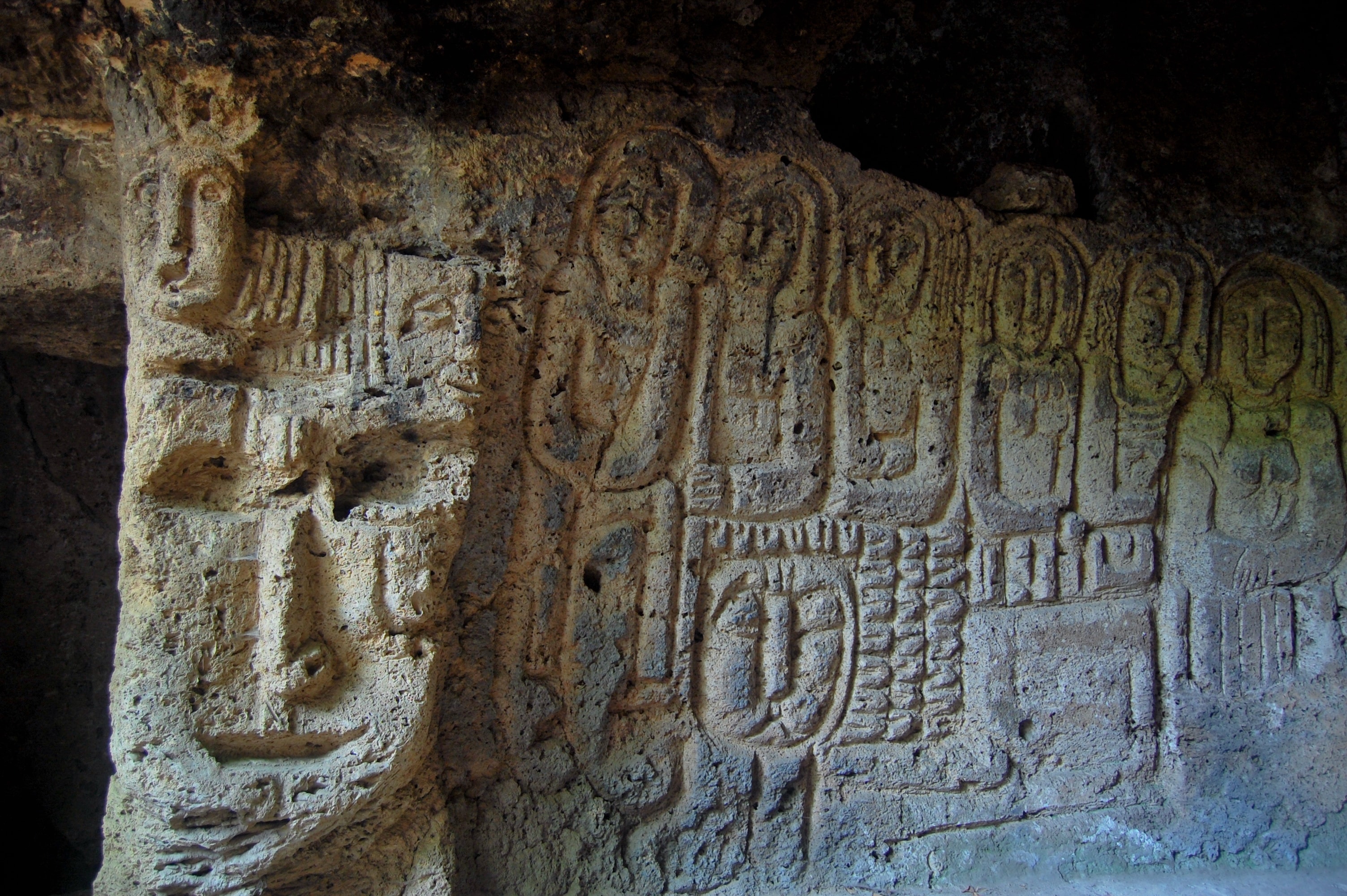
Only tree trunks stacked one atop another, shaped like a raft, once led up to the chambers—hence the name: Lastiver, "up on the raft." For decades, visitors mistook the reliefs on the walls for ancient relics; sculptor Benik Petrosyan carved them only in the 1970s, chisel in hand and patient. You feel your way up the steep rock face and suddenly stand before figures that look older than they are.
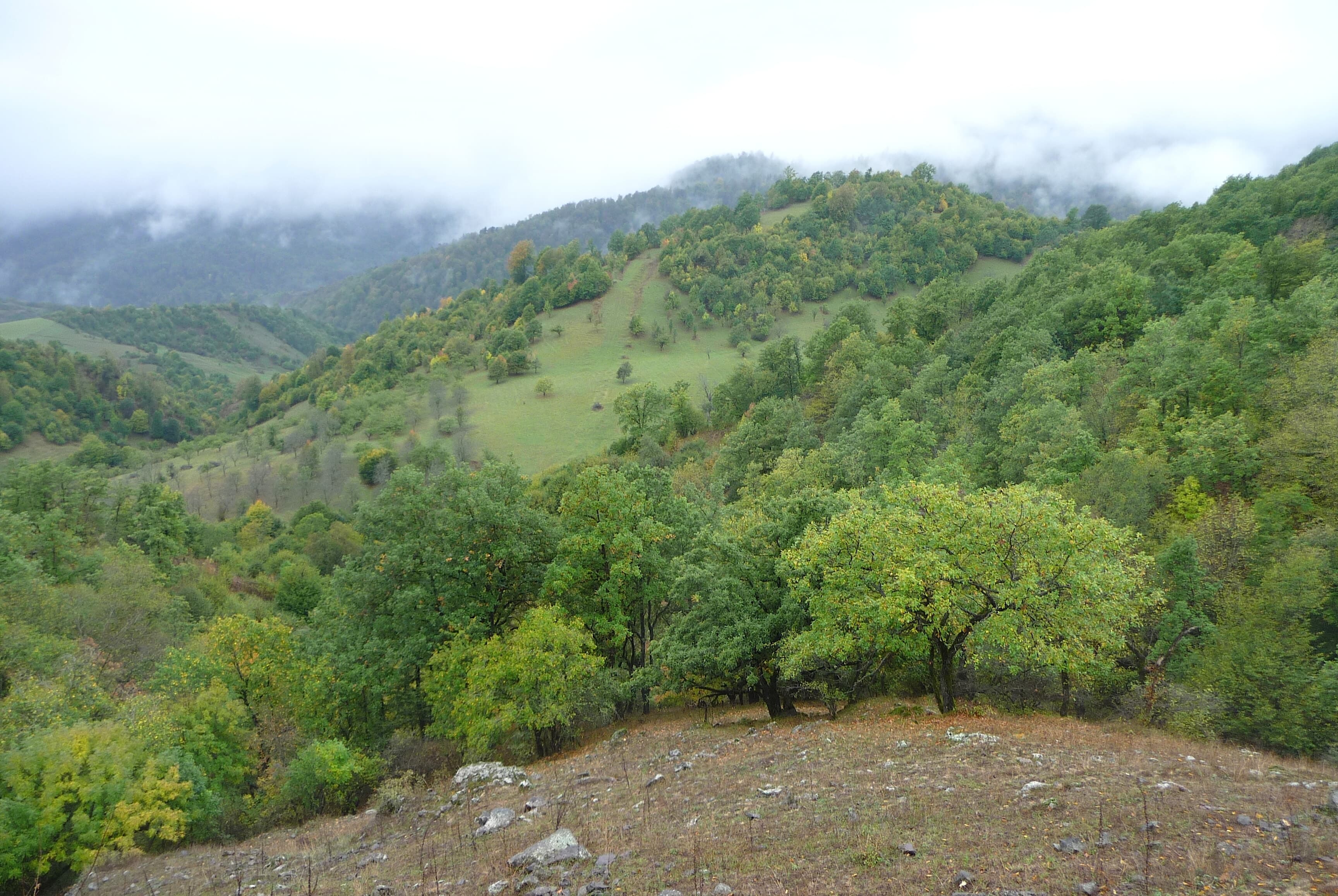
The Lastiver caves stand at approximately 1,250 metres elevation on the steep rock face of Khachaghbyur Canyon, nestled within the dense mixed forest of Tavush region, roughly three kilometres southwest of Yenokavan. Access to these chambers demands physical exertion: the cliff face drops nearly vertically, and historically, visitors relied on a timber structure—resembling a raft when stacked—as a climbing aid. The name derives from this method: "last" in Armenian means raft, and Lastiver translates roughly as "up on the raft." The caves themselves comprise several natural chambers and rooms hewn into the rock; the most prominent bears the name Anapat, an Armenian term meaning "solitude" or "wilderness"—language that suggests its function as a hermitage.
Offroad & access
Offroad factor: 4 out of 5. The drive from Ijevan to Yenokavan follows asphalt, then gravel and forest tracks toward Apaga Resort. Motorised vehicles cannot proceed beyond the canyon rim. The vehicle is left at the upper edge of Khachaghbyur Canyon; the final 2.5 to 3 kilometres are completed entirely on foot. The trail descends steeply through thick woodland, over damp roots and loose rock, at times alongside a rushing mountain stream. Total walking time to cave and back: approximately 2.5 to 3.5 hours depending on pace. Sturdy footwear is essential; after rain, the path becomes slippery. A 4x4 vehicle with low-range capability is recommended for forest tracks, particularly outside peak season.
Region: Tavush | Coordinates: 40.9419° N, 45.0306° E | Elevation: approximately 1,250 m | Nearest settlement: Yenokavan | Best season: May to October | Admission: free | Access: from Apaga Resort or Yenokavan approximately 2.5–3 km on foot through the canyon | Torch required | No organised tours on site, no infrastructure within caves | Mobile signal: weak to absent in canyon | Wildlife in region: lynx, fox, badger, raccoon
The earliest traces of human use in Lastiver caves reach back to pre-Christian times. Cells, stone beds, and niches cut into the rock point to permanent habitation. Christian communities—likely early and High Medieval—expanded these chambers and left carved crosses and khachkars (cross-stones) on the walls. The name "Anapat" for the main cave suggests monks or hermits used this isolated location as a retreat. In the 13th and 14th centuries, during Mongol invasions, these hard-to-reach rock chambers served the local population as shelter and refuge. The terrain's steepness offered natural defence; once the timber ladder was withdrawn, foot-soldiers faced near-impossible access. A more recent chapter was written by Soviet-Armenian sculptor Benik Petrosyan (known as Beno), who spent several months in the caves during the 1970s, creating bas-reliefs on the walls. His works—figures, abstract forms, and a scene researchers identify as a wedding feast—deliberately echo pre-Christian rock engravings and were long mistaken by visitors for ancient artefacts. Petrosyan was known for small-scale work; Lastiver represents his most unusual, site-specific project.
According to tradition, villagers would cry "Lastni Ver!"—"Pull up the raft!"—as they hoisted the timber ladder, and this call gave the entire location its name. This explanation appears widely in Armenian travel sources but lacks historical evidence; it likely represents folk etymology. What is established is that the Armenian word "last" genuinely denotes a raft or wooden structure, and that the original access method to the rock chambers involved stacked timber. Beyond this, Lastiver has long been regarded as a sacred site, as suggested by the many ritual markings on its walls—an oral tradition maintained in the region as conviction, though the precise pre-Christian ritual practice remains undocumented.
Lastiver condenses three historical layers into one confined space: pre-Christian habitation, medieval defensive function, and an unusual Soviet-era artistic project—all on a cliff face that was nearly inaccessible without aids. The canyon itself, its waterfall, and the undisturbed beech forest make the journey itself intrinsically worthwhile. Because the site contains no tourist infrastructure and access is only possible on foot, visitor numbers remain modest.
Begin from Yenokavan or Apaga Resort (approximate coordinates: 40.95° N, 45.02° E). From the canyon rim, a marked but unprotected trail descends into the ravine; after rain or with snow patches remaining (possible into May), it becomes slippery. A torch, adequate water, and sturdy footwear are mandatory. The caves are freely accessible year-round, but May to October is preferable due to trail conditions. Mobile coverage is unreliable in the canyon. Overnight option nearby: Apaga Resort provides wooden cabins and tent pitches.
TavushMonastery
LoriMonastery
TavushMountain
Armenia Expeditions arranges transport to the canyon rim and advises you beforehand on trail condition and equipment, so you can explore Lastiver's caves at your own pace—no surprises. One message — we’ll plan the rest.