Off-road
GegharkunikLake
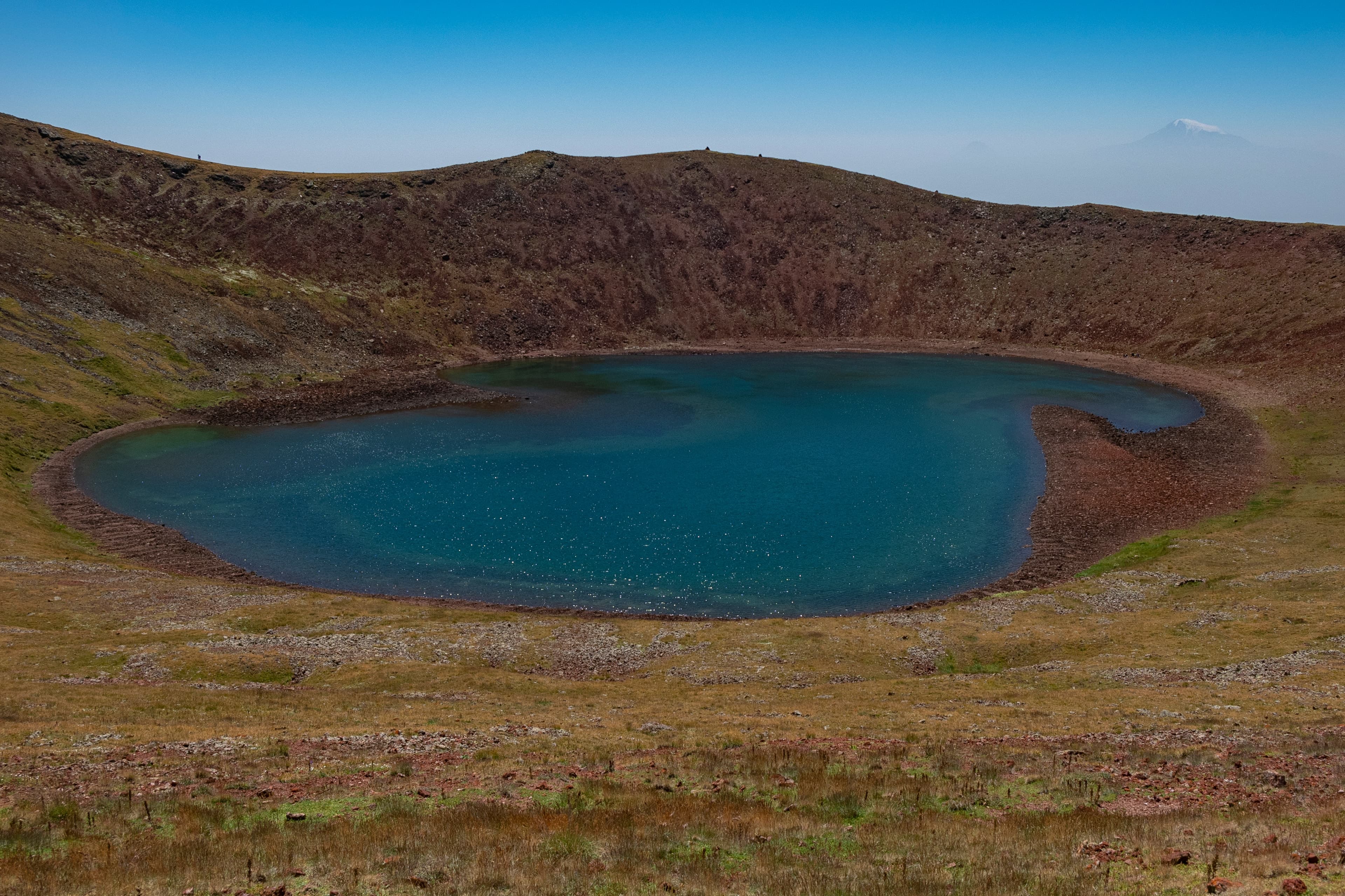
Gegharkunik — At 3,032 meters elevation sits a perfectly circular crater lake amid extinct volcanic cones: Lake Akna, nestled in the highland meadows of the Geghama range, has been a state-protected natural monument of Armenia since 2008.
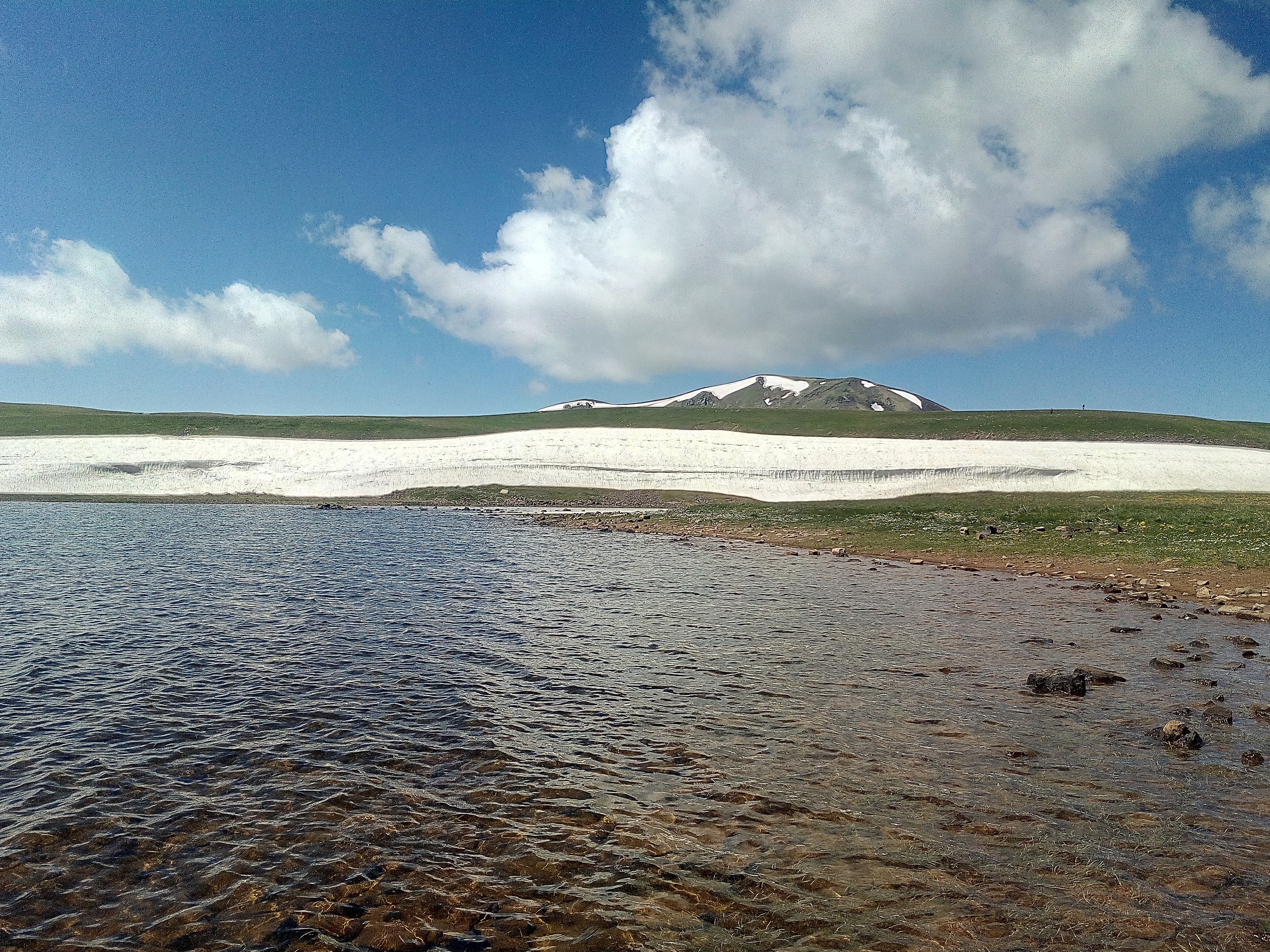
In Armenian, "Akn" means eye, spring, and pit all at once, and you find yourself looking into a lake that stares back like a pupil. All around, between 2,600 and 3,200 metres, lie more than 12,000 documented rock carvings: hunting scenes, dancing and fighting figures. Fish-shaped vishapakars, the dragon stones, are said to have once stood as guardian spirits at exactly such water sources — no one knows whether one ever watched over this lake too.
Lake Akna lies in the central part of the Geghama Mountain chain, on the border between Gegharkunik and Kotayk provinces. The lake fills a volcanic crater and covers approximately 0.8 km² with depths reaching 15 meters. Fed exclusively by snowmelt and springs, the basin is bounded on all sides by surrounding peaks – Aknasar, Narine, Shushan, and Shamprasar. The entire Geghama volcanic field is geologically recent; the last volcanic activity in the region dates to around 1900 BCE. The water is clear and drinkable. In calm weather, peak silhouettes and sky mirror on the water's surface – an optical effect that may have inspired the lake's Armenian name.
Offroad & access
Offroad rating 3 out of 5. The approach begins at the village of Sevaberd and proceeds over highland gravel and grass tracks into the Geghama plateau. The route features potholes, loose stones, and depending on season minor stream crossings. In wet conditions grass tracks become slippery; traction loss on moist volcanic soil is possible. A 4x4 vehicle with adequate ground clearance is recommended; 2WD vehicles regularly fail in wet conditions. Snow-free passage is reliable only from mid-June onward. The route through open highland offers sweeping views of surrounding volcanic cones; the final stretch to the lake shore can be partly covered on foot.
Location: Geghama range, Gegharkunik/Kotayk border | Elevation: 3,032 m | Lake type: Volcanic crater lake | Area: approximately 0.8 km² | Depth: up to 15 m | Water supply: Snowmelt, springs | Protection status: State Natural Monument of Armenia since 14 August 2008 | Nearest settlement (starting point): Sevaberd | Best season: Mid-June through October | The lake freezes completely in winter.
The Geghama Mountains were inhabited and used since the Bronze Age. At elevations between 2,600 and 3,200 meters – directly in the immediate vicinity of Lake Akna – over 12,000 rock carvings have been documented. They depict hunting scenes, animal motifs, dancing and fighting humans, and representations linked to fertility and ancestor cults. Particularly striking are the so-called Vishapakars (dragon stones): fish-shaped stone monuments from the second millennium BCE traditionally placed near water sources and highland pastures. The Geghama region holds the densest known concentration of these monuments in all of Armenia – roughly 90 of approximately 150 documented examples. In the 1980s, Lake Akna was used for a conservation program of the endemic Sevan trout-perch (Ishkhan): spawning fish were relocated here to preserve genetic diversity of the species as Lake Sevan water levels declined.
The lake's name derives from the Armenian term "Akn," which simultaneously means "eye," "spring," and "pit." In Armenian language and worldview, eyes and water springs were traditionally closely linked – both were seen as life-giving and sacred. According to tradition, Vishaps, the dragon-stone figures of the Geghama highlands, were deliberately placed at water sources and lake shores because they were seen as spirits or guardian deities of water. Whether a specific Vishap stood concretely at Lake Akna's shore is undocumented; however, the close spatial relationship between these monuments and alpine lakes in the region is archaeologically confirmed.
Lake Akna is one of the few fully intact volcanic crater lakes in Armenia above 3,000 meters that is vehicle-accessible. The basin lies remote from any tourist infrastructure amid a highland landscape of archaeological, geological, and ecological significance. The combination of extinct volcanic cones, Bronze Age rock carvings, and a state-protected alpine lake on a single approach is exceptional in this density. Those who know the Geghama plateau understand why ancient Armenian peoples held this landscape sacred.
Starting point: village of Sevaberd, Gegharkunik province. Vehicle: 4x4 strongly recommended; even with 4x4, caution is warranted in wet conditions or fresh snow. Season: mid-June through October; before and after, snow fields and saturated tracks prevail. Bring provisions and ample water – no facilities at the lake. Weather in the highlands changes rapidly; pack rain protection and warm clothing even in summer. The lake is under state nature protection (natural monument since 2008); camping and fires directly at the shore are prohibited.
GegharkunikLake
KotaykMountain
Upper Azat valleyMonastery
Armenia Expeditions brings you by suitable 4x4 vehicle and local guide from Sevaberd directly to the crater lake – including orientation to the Bronze Age rock carvings in the surrounding area. One message — we’ll plan the rest.