Paved
Vayots DzorMonastery
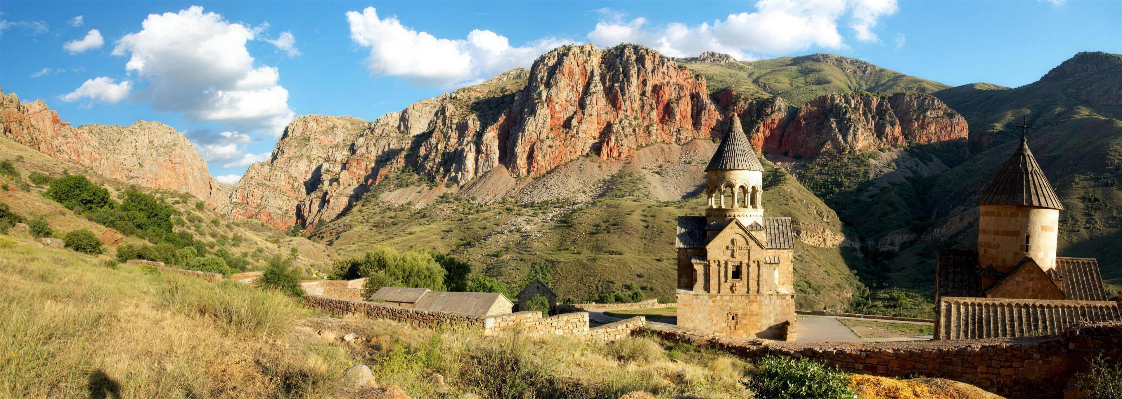
Vayots Dzor — Beyond Areni opens a gorge of brick-red rock faces through which the Amaghu flows. At 1,400 meters lies the Jafar Grove by the water; from there only a rough gravel branch descends further. Griffon vultures circle overhead, bezoar goats cling to the slopes. To reach here, you need a four-wheel-drive vehicle and dry weather.
After rain, thin waterfalls briefly stream over the red rock edges, then only the gorge’s silence remains. The protected area, more than 14,000 hectares, counts close to a hundred breeding bird species, yet its real rarity stays hidden: the Caucasian leopard is said to retreat into these remote walls. You drive through fords, never knowing who might be watching from above.
The Gnishik Gorge lies in the south of Vayots Dzor Province, above the village of Areni and not far from Yeghegnadzor. Over long timescales, the Amaghu has carved deep into the rock, exposing steep, nearly vertical walls. Their striking reddish-brown hue stems from iron oxide in the stone; after rain, brief waterfalls cascade over the edges. The gorge is named after the village of Gnishik and the river of the same name upstream. The valley floor sits around 1,400 meters. At the bottom, by the water, stretches the Jafar Grove, a shady clearing with mature trees, where the actual trail into the gorge begins.
Offroad & access
Offroad rating 4 out of 5. From Yeghegnadzor, follow the primarily paved H40 toward Gnishik. Just before the village, a rough earth and gravel road branches right; from here, all-wheel-drive is essential. The track descends to the Jafar Grove at the river; further into the valley, the trail weakens and crosses the Amaghu at several shallow fords. The ground is loose, some sections are washed out and difficult to pass after rain. Allow significantly more time than the distance suggests for the few kilometers from the turnoff. A capable 4x4 vehicle with low-range gearing and adequate ground clearance is recommended. In wet weather and after storms, postpone the drive. Mobile reception is largely absent in the gorge.
Region: Vayots Dzor, nearest town Areni. Location: 39.66 N, 45.29 E, valley floor approximately 1,400 m. The gorge is part of the Gnishik Protected Area (Noravank Important Bird Area), covering 14,002 hectares. About 100 breeding bird species and 46 migratory and wintering guests are documented. Characteristic are the raptors: griffon vultures, bearded vultures with a dedicated feeding site, lappet-faced vultures, lammergeiers and golden eagles. The slopes harbor bezoar goats, and the area serves as refuge for the rare Caucasian leopard. Habitats range from riparian scrub and semi-desert through juniper forests to dry mountain steppe. Best season: May to October.
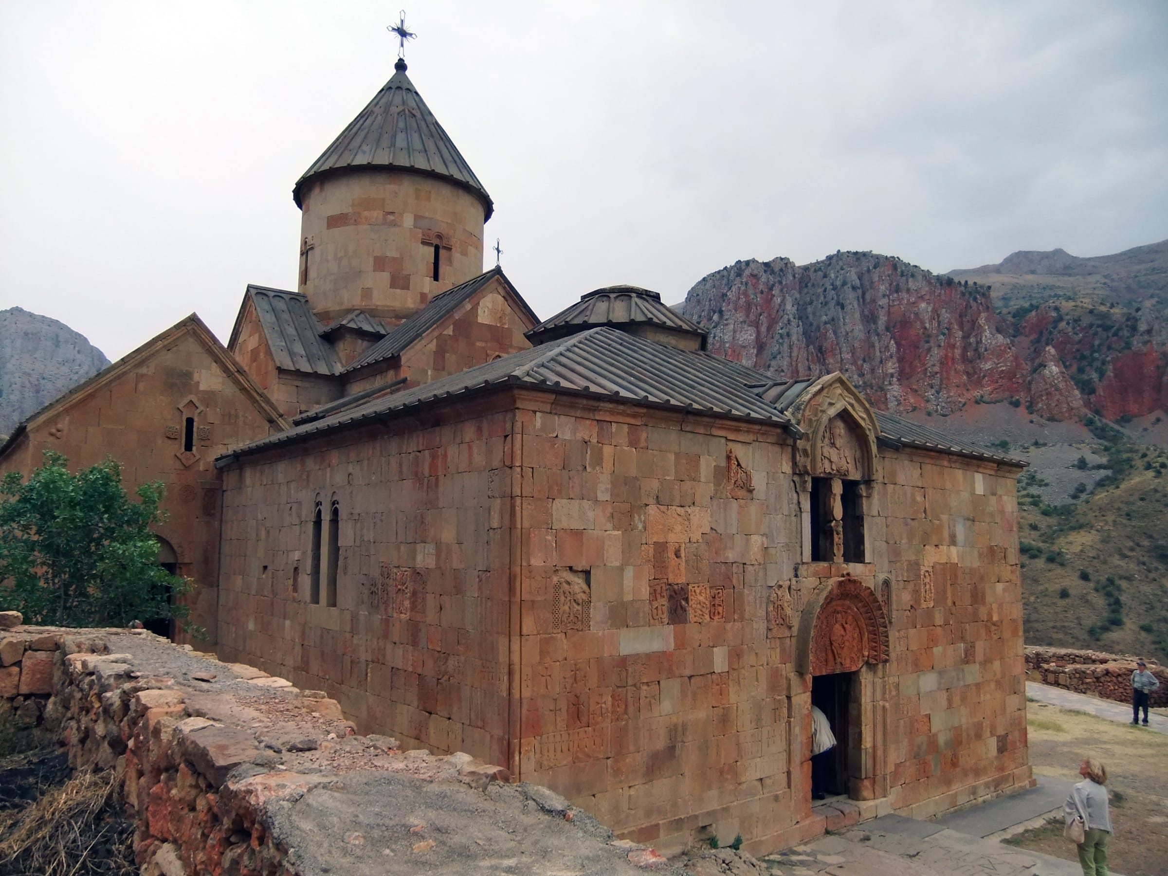
The gorge lies within the environs of Noravank Monastery, which emerged in the 13th century in the Amaghu Valley and became a significant spiritual and cultural center of Armenia under the Orbelian princes. In the medieval period, parts of the valley were cultivated as gardens belonging to the Noravank monastic community. Traces of earlier settlement are visible in the surroundings: near Rind stand khachkars (cross-stones) dated to the 9th–10th centuries, counting among early examples of this stonecraft. The valley floor with its paths served for centuries as a connection between the higher villages and the monastery below by the river.
No distinctive, documented legend about the gorge itself has been transmitted. The name provides more insight: the gorge bears the name of the village Gnishik upstream on the river of the same name, which gave the valley its designation. The Jafar Grove at the valley bottom is named locally after a personal name; no verified interpretation exists. Regional storytelling centers chiefly on Noravank Monastery and its builders, less so on the gorge itself. We keep the tradition here intentionally brief and separate it from verified facts.
The Gnishik Gorge unites three elements at one location: red canyon rock, an unusually dense raptor world, and an access that closes the terrain to many visitors. While Noravank itself is readily accessible, the valley floor at the Jafar Grove remains reserved for vehicles capable of handling the gravel branch and fords. With patience, you observe griffon, bearded, and lappet-faced vultures soaring over the walls and, with luck, bezoar goats on the steep slopes. It is a brief, technically honest drive into a protected area most know only from the monastery parking lot.
Best time: May to October, outside rain periods. Vehicle: experienced 4x4 with low-range and good ground clearance; avoid driving after precipitation. Check Amaghu water level before fording, as levels rise after rain. Bring drinking water, sun protection, and sturdy footwear; no reliable mobile reception in the gorge. The area is protected: stay on trails, maintain distance from wildlife and nesting sites, leave nothing behind. Binoculars are worthwhile for raptors. The starting point is the H40 from Yeghegnadzor toward Gnishik; the turnoff to the Jafar Grove lies just before the village.
Vayots DzorMonastery
Vayots DzorNature
Areni, Vayots DzorWine
If you wish to experience the Gnishik Gorge apart from the monastery parking lot, Armenia Expeditions plans the approach via the gravel turnoff to the Jafar Grove with all-terrain vehicle and local guidance. We adjust pace and timing to weather and water level so fords remain safely passable. One message — we’ll plan the rest.